I was helping a friend set-up a new blog this morning and in the process forget how much effort it took; how much time I’d spent setting this one up. I also exposed myself to the WordPress tool-set for the first time in months and found it had undergone remarkable improvement in ease of use since last I had occasion to visit. Even so , Continue reading
Category Archives: Parks
Glen Canyon Crossing

Glen Canyon Crossing
10
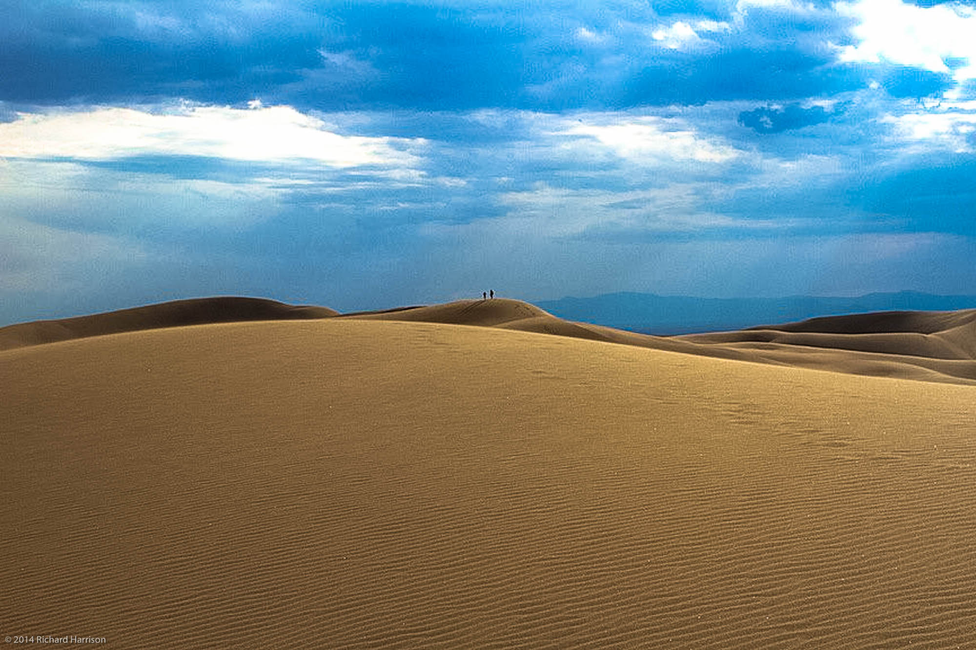
Great Sand Dunes National Park
And then a few minutes later the storm hit…..
Sometimes the trail can be difficult to find but it’s almost always a rewarding search
10
10
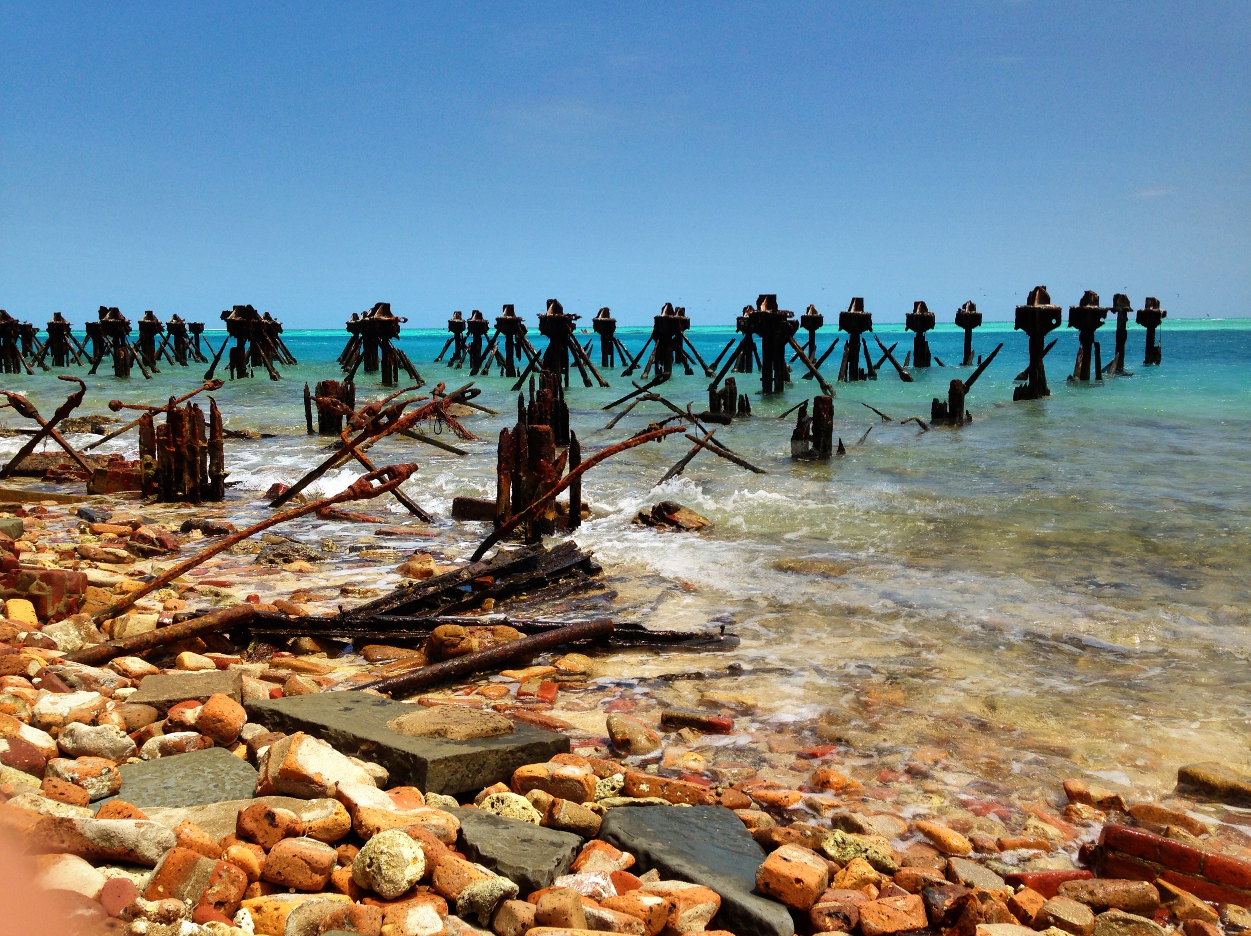
Forbidden Bay
This One’s For Mo

10
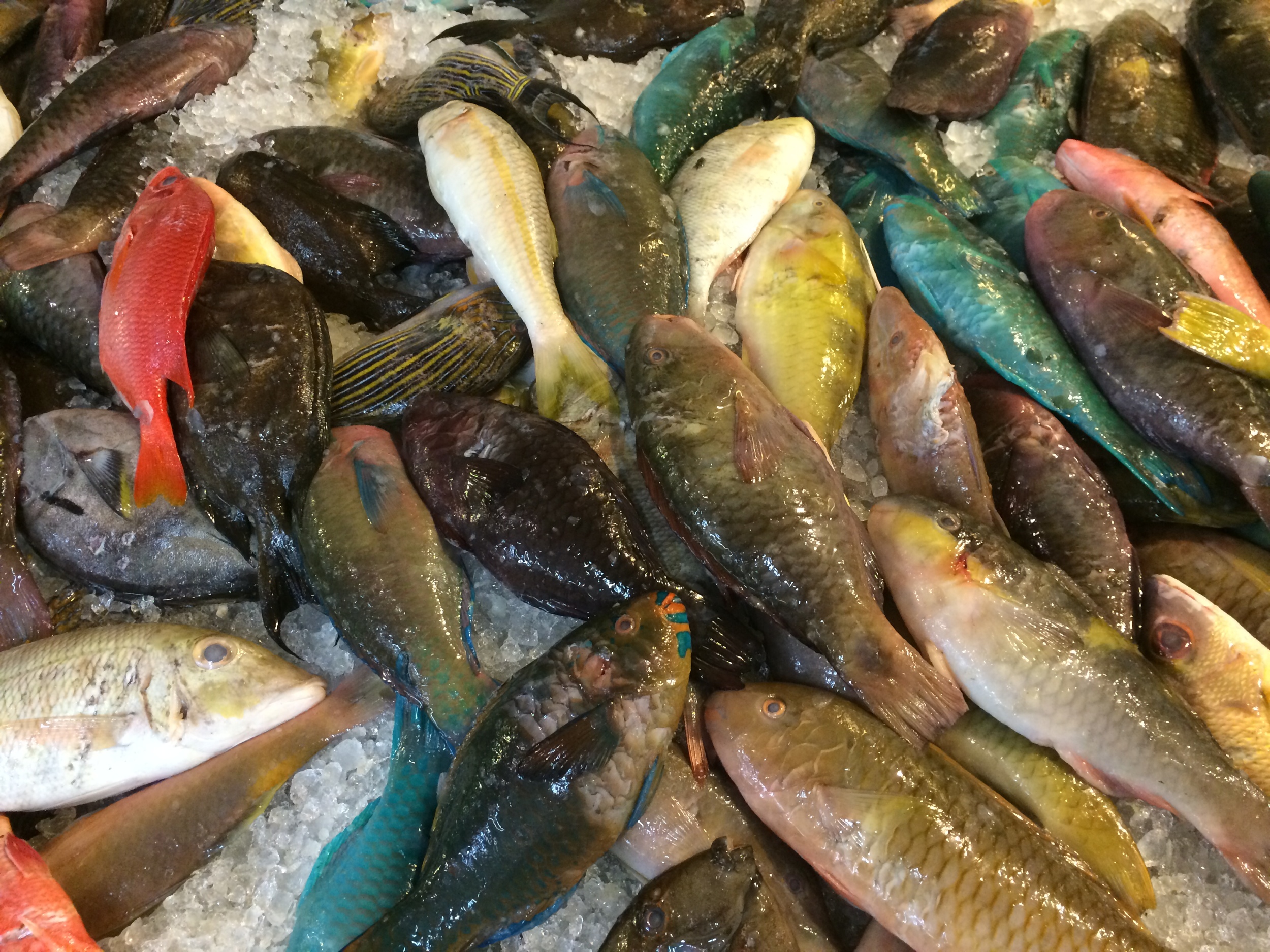
Iced Exotic
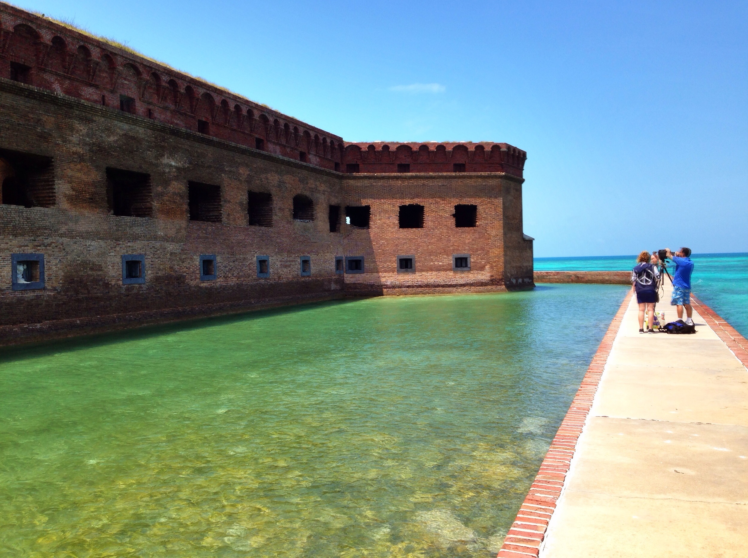
Completed The Parks Project in the Lower 48: Hat Trick + 1
Yesterday I visited my 48th US National Park – Dry Tortugas NP – roughly 70 miles west of Key West and with that completed the tour of the three NP’s located in Florida. The other two are Everglades, which I’d have to put in my top ten, and Biscayne, about which there is not a lot to say.

The +1 was St John US Virgin Islands National Park. It’s not in the Lower 48 but I happened to be in the neighborhood. First trip to the West Indies – discovered I’m probably not an island sort.
The theory will soon be tested though. The next Hat Trick is Hawaii+American Samoa in May.


10
Scooter Bob
Despite good intentions, I was not up and about very early this morning. Too much coffee the night before and still too left coasty time zoned. But after a light breakfast at the Inn I’m staying at I wandered downtown in search of a vehicle; specifically a motor scooter. The people at the Inn had told me there were ones to be found in Wharfside Village.

Downtown Cruz Bay
Sure enough it didn’t take me long to ferret out the rental place. There was not a lot else going on that time of morning and few people about save the two women in front of me turning their vehicles in.

Scooter Bob’s Death Machines
“Can I help you?” says Bob.
“I’d like to rent a scooter to tour around the island” I say.
He smiles and inquires if I have any experience with a scooter.
“Well, I’ve never actually driven a scooter but I have driven motorcycles, ah, one motorcycle, and I know how to ride a bike. Will that do?”
“I don’t know” says Bob. “How long ago was that?”
“Ummm” “Probably ten years or so.” (Why am I lying? Try thirty years ago, and then only for an afternoon on my roommates Suzuki. Ego! Egads!)
I get a very – well deserved – skeptical look.
“Don’t you think you’d be more comfortable in a something with four wheels? A Jeep?” says Bob. “We have those too.”
“Maybe” “But these look like a lot more fun than a Wrangler.”
“Ok” says Bob and hands me the forms to fill out. When I’m finished he displays a map of the three major roads and very carefully describes how steep, hilly, curvy, hair pinned and dangerous each of them is.
“Think that will be ok for you?” he says.
“No problemo” I respond with a distinctly hollow sense of confidence.
So he shows me how to start the thing, points out the front and rear brake handles and the throttle, hands me a helmet and wishes me a good day.
I got on. I got it started. I was feeling pretty good about the situation. Then I released the brake handle and turned the throttle. Whoa! Scoot left. Scoot right. Buck a little. Both legs spread to the side to ward off, well, everything.
I’m thinking to myself: This is the dumbest fucking thing you’ve attempted since Angels Landing in Zion NP. In fact every additional foot I made it down this otherwise quiet street, the more idyllic Angels Landing was looking as a memory.
I made it to the end of the street, which fortunately was one way in the direction I was heading.
A stop sign. Thank God! Time for a break. That first hundred yards or so was, ah, exhilarating. Needed to catch my breath.
I’m now faced with a few (possibly grim) realities: I have to leave this spot in a matter of seconds. It says stop, not rest. I have to figure out – and fast – why my two hands and two feet are having such a hard time communicating with one another. I have to make a left turn on a two-way street subject to ridiculous British driving rules and I’m not entirely sure which side I need to be on. I have to quit feeling as ludicrous as I’m sure I look to the people standing on the corner waiting for me to make my move so they can get on with their day. I have to fight the urge to dump the scooter and run – before it dumps me. And last I have to face the fact that I’m probably about to die.
I made the turn. Unbelievable! Maybe this isn’t as terrifying after all as the first minute or so seemed. I even made the next turn. The next stop sign was at the major intersection downtown. I panicked and pulled to the curb – working on my next move: Brake? Throttle? Which way? What!?!
I see Bob running down the sidewalk waving his arms at me. He had circled round the block in the opposite direction. For a second I’m wondering why. But only a second.

Scooter Bob
“Mr Harrison” he says, “Maybe you ought to rethink this.” “You looked a little shaky when you headed out.”
“Really?” “Well, you know. I should get the hang of it soon, don’t you think?”
“I’m sure you can” he says. “But you’re on vacation. Why stress out over a scooter? You can do scooters any day but you can’t do St John except now. Do yourself a favor. Let me get you one of my Jeeps. What say?”
Bob is good at this. He probably chases half his would be scooter customers down that street. He’s in good shape. I’m glad he’s practiced.
“Well, you talked me into it. Have you got a red one?”
“I do”, he says. “I’ll take the scooter and go get it and meet you back at the stand, ok?”
“OK”
And that is how Scooter Bob saved my life after having been dumb enough to rent the damned scooter to me to begin with. True to his word he pulled up at the stand with a red Wrangler that had also been around the block a few times. But it sat steady on four wheels and had brakes and steering in the places God meant them to be. My feet and hands were back into themselves – as was I.
When I say Bob saved my life, he did. The roads on SJ are horrendous. Navigating them in the Jeep turned out to be quite a task. Hair-pinned switchbacks on 20 degree grades with no shoulders and on the wrong side! I would not have survived on that scooter.
Bob overcharged me for the Jeep by $20 or so and I knew it but I figured I owed him one. And I’ll certainly give him a good recommendation on Yelp! or whatever.
Thanks, Scooter Bob. You did well and I’m here to tell the tale.
And to show you one of the things I got to see:

Sir Frances Drake Channel between SJVI and Frenchman’s Cay, BVI
10
10
Bright Angel
A bird’s eye view of the Bright Angel Trail, Grand Canyon National Park, AZ, USA

Santa Elena Canyon
Trailhead – Santa Elena Canyon, Big Bend National Park, Big Bend, TX USA

Trailhead to the Santa Elena Canyon
10
10
10
10
10
10
10
Chiricahua National Monument
A few shots from Chiricahua National Monument near Willcox, AZ.

Sunset from Massai Point
10
10
10
10
10
Preferences
I’m closing in on my goal to visit and shoot in all our National Parks – at least those in the Lower 48. Five to go and I will visit those on my trip back west which will begin in a couple of weeks. People invariably ask me which is my favorite Park and it’s almost impossible to answer that question. I’ve visited a couple that are non-favorites (they shall go unnamed) but the plus side of the ledger is more difficult to deal with. However, of those that I have visited – and realize this does not yet include Hawaii, Alaska, Guam, or St. Johns – there is one that stands out for me. Were you to ask me to name the Park I would go to, if ever I could only visit just one more, I’d say Death Valley.
It may have been the time of year I first visited. It might have been my state of mind. It might have been the way the light caught the side of the mountains in the morning and then again in the afternoon. It might have been the dunes. All those things. Other things. I don’t know. I’m sure had I arrived in a sand storm or in mid-July my opinion would be quite different. But I didn’t. And so all these things and more combine to push DV to the top of my If-I-Only-Could_Visit_One More list.
Inasmuch as my only (and favorite) daughter married a couple of days ago you might wonder just why I’m posting about Death Valley. I know I did. But you see I never post without images and the ones from the wedding will not be available for a while. That and the fact that I was scouring through files this afternoon looking for a good shot to submit for a contest accounts for this post. At some point I will link it to a gallery that will go up on my SmugMug site, but for now I’m satisfying my need to get something out in lieu of it’s creation and in frustration over not having wielded a camera at the wedding.

10
10
The Mono Basin

The Grotto at South Tufa, Mono Lake in the Eastern Sierras
I was first introduced to the Mono Lake Basin in September 2011 on a trip with my son Charles and his Green Tortoise Travel bus and have since had the opportunity not only to spend a lot of time exploring there, but more importantly to become acquainted with and a part of the Mono Lake Committee, a conservancy organization co-founded by the late David Gaines that has been in operation at ML since the mid-80’s. It’s very safe to say that lacking the efforts of the MLC there would be no Mono Lake today. It would have long since gone the way of Owens Lake a little further south of the Basin. Owens, despite its ‘lake’ designation, is now a very large salt flat: Picturesque. Toxic.
Not so Mono Lake, which even bearing a salinity level exceeding twice that of the Pacific is one of the liveliest (and loveliest) bodies of water on earth. It plays host to trillions of brine shrimp which control the lake’s algae levels and provide a critical food source to the millions of migratory birds that use Mono Lake annually. The shrimp are also a staple for about a third of the world’s California Gull population that calls this place its nesting home.

Pastimes
I became a volunteer with the Committee this past spring and commuted up from Los Angeles over a period of several weeks to get the training necessary to the work and then to actually deliver on that investment before leaving for the east coast in mid-July. The photographic materials piled up and for the most never got posted so I thought I’d better do something about that before it slipped away entirely. I’ve culled through my logs and come up with a couple hundred shots. It’s overkill I suppose but does offer a reasonably good view of my activities over these many months. It also includes shots of the volunteer group I was a part of, led by a very dedicated former California State Park Ranger, Janet Carle. Janet, and her husband David, also a former ranger at Mono Lake, have published a book entitled Traveling the 38th Parallel which ties together global water issues common to the latitudinal band that intersects the Mono Basin. Well worth looking at.
And Mono Lake is well worth visiting. If you find yourself traveling to Yosemite or anywhere in the Eastern Sierra area you’d be well rewarded making the trip to the Lake, to the Bodie Hills and Mono Craters and to the little town of Lee Vining hard by the shoreline. If you happen there next spring look me up. I’ll be the guy hanging around the Old Marina on the west end sporting a Mono Lake Volunteer vest and a spotting scope to keep an eye on the Osprey that nest in the towers. Be happy to give you a tour. By next year I might even be able to name a few of the other species that call this place home.
10
Shameless Self-Promotion
You can all attest: I rarely if ever tout my work here. I just throw out what I think is proper – sometimes good; sometime not so good – and let you be the judge. Invariably the feedback adhere’s to what my mother and I suppose yours taught: If you haven’t anything nice to say, say nothing at all. It’s not well-informed, constructive criticism but neither does it trample on ego’s and good intentions.
So, having said that I think what follows artistically constitutes some of my best work to date. Most of it has been subjected to minor color correction and there is a crop here and there but a goodly chunk is SOOC (straight out of the camera). In past when I’ve examined other’s works described this way I think “Yeah. Right” because until now I’d not experienced the effect.
I can’t say that anymore.
The composition worked. The light was gorgeous. The scenes fit well into a visual description of the subject – Henlopen State Park in Lewes, DE USA. The sun cooperated. The Delaware Bay Ferry co-operated. People on the fishing pier were friendly and open and curious and did not run away or throw things at me. It was a great outing.
I went down on this past Saturday morning. I had been unable to get a campsite for Saturday but my friend Indre had so we shared it and then when she left on Sunday I stayed over another night. Indre has camped in this park for years and knew the area well so I was fortunate to have an informed guide on day one. On day two I took advantage of the tutelage I’d gotten on Saturday afternoon. Would be nice to work under these conditions everywhere I go.
And then there’s the histogram. That little graph that pops up on the back of my DSLR after each shot to tell me….
Well, until recently I had no real idea what it told me. I did not know a good graph from a bad one or why one was good and one wasn’t. I knew it must be of some value else Canon would not have seen fit to include it as a feature but just what that value was? I was clueless until I stumbled upon a couple of ebooks that talked about how to make use of the information to improve (hopefully) the outcome of my efforts behind the lens. It took a while but it seems to me to have paid dividends in this shoot.
I capture my images in RAW format. This allows me the greatest degree of flexibility in post-process by maximizing the number of pixels I have to work with. By comparison a jpeg format compresses most of those pixels into digital mush before they arrive at post-process. The histogram essentially tells me if I am capturing as many pixels across the white-black spectrum as I can. The more even the distribution the better. Do this well in the right light and you get something like what you see here and over in the gallery if you go. I hope you do.
I was very pleased and that is not often the case – I’m m own worst critic: I beat me up over this stuff all the time.
But not this time. In fact I think a couple of these are going to wind up on walls. Mine or someone else’s. Or both.
Thanks for dropping in. If you’re nearby Henlopen you’re quite fortunate. Click through the pic to see more.

10
10
It Was A Day For Rocks
If you click the photograph you’ll see what I mean.
Taken mostly near Cade’s Cove in Great Smoky Mountain National Park although toward the end you’ll notice a few I along the Blue Ridge Parkway in North Carolina

10
Big Meadows in the Fog
Big Meadows Camp in the Shenandoah National Park was a family weekend destination when I was a child. I can’t remember the last time I was here so I couldn’t resist a brief stop. It’s changed a little. More posh than I recall. But the trees remain the same – only more attractive in fog.

Rainy Homecoming
It started raining just after midnight and hasn’t ceased or even slowed since – has me pinned in my tent pondering the rain gear stored in the car.
Rain of this magnitude – it’s really pouring – is a normal occurrence in the Mid-Atlantic region though usually not this early in the season. Trees begin storing water in the fall to create the sap necessary to get them through winter. But early fall is six weeks off. I keep thinking as I lay stretched out here on my sleeping bag how welcome this rain would be in the Eastern Sierra – Mono Lake especially comes to mind. But if I’ve learned nothing else out here it’s that Nature is what it is; fiddling with it can be problematic. Adjusting is a better approach. As Charles says ‘It’s never a matter of wrong weather just wrong kit.’ In this case it’s right kit; wrong storage location. And a soaking trip in between.
When I arrived in Shenandoah National Park yesterday, after completing the three day run of the Blue Ridge Parkway, the sky was near crystal clear. Very unusual here where a haze is almost constantly present from the summit of Skyline Drive out across Shenandoah Valley. Not yesterday afternoon. Visibility was excellent, better than I’d ever remembered from my many trips here over the years. I immediately anticipated a grandelicious sunset. That was around 1400.
But there was rain to the south headed our way. I believe there’s something called a Tropical Depression running round the Gulf so this might be a result of its presence. This is the early edge of hurricane season in that area which tends to frequent rain in this area. (Rain is much more welcome than a hurricane.) Anyway, as the clouds rolled in about 1600 my hopes began to fade. But I thought there might be a chance so, after getting camp set up and grabbing a couple of Reese Cups and a bottle of Gatorade for dinner at the camp store, I drove the ten miles or so south to Turk Mountain Overlook and took up the vigil, camera at the ready.
Didn’t happen.
What you see, compliments of iPhone, did.

What you don’t see is my hesitance to open the tent flap and make a dash for the car to retrieve the gear I should have placed in the tent last night. I’m sure I’ll rally soon. In the meantime I’ll enjoy another chapter of Twain’s Roughing It<a
Au Sable Point – Pictured Rocks National Lakeshore
I suppose the real cause of my all night drive from Pictured Rocks National Seashore resulted from my dalliance along the Au Sable Point Trail. I had seen the Au Sable Light from a vantage point along the dunes about five miles north near Grand Marais and decided I needed to get a closer look. It’s reached by a trail located just off the north perimeter of the Lower Campground, about a mile and a half from the lighthouse, so when I finished up tramping around the dunes I drove down that way.
By the time I reached the trailhead it was 1930. I calculated the walk would require 30 minutes one way and given that I’m still way north (46 degrees) I’d have plenty of time to get out there do some photography and get back before dark. I was thinking about the Light not the sunset and relished the idea that for once I would be approaching my subject both at the right time of day and under near perfect weather. One of those rare times when my schedule coincided with the right everything.
The Lower Campground is hard by the lakeshore. I parked and proceeded up the path. It runs parallel to the and within feet of the shoreline providing a panoramic view of Lake Superior. As I trudged along it occurred to me that in addition to the Lighthouse I might also be able to capture shots of the sunset over the lake.
I took my time at the Light and shot it from as many angles as I could. It has stood on the point since 1874 and is one of tens such lights found around the Great Lakes area. If you’re into light houses this is the place to be – much more so than on the east or west coastlines. The shots will be the subject of the next post because I was more taken – at least for now – by what followed that part of the shoot.
I finished up, working my way around a few late evening visitors who arrived in time to clutter up the view, and headed back down the trail at a quick pace. I planned on finding a spot on the beach near where I had parked the car and taking in the ending of the day. I arrived about 2030 and looked around for a spot. It was then I also realized that I had plenty of time to run and get my tripod – always a last-minute and usually overlooked thought – as well as a lens filter that would help to cut the sun’s glare and capture more of its coloration. So I picked the items up and headed back to the beach.
I was surprised to see that just left of the place at which I entered the beach a creek was flowing into the lake at moderate to high velocity so I settled on a spot that placed its exit point between me and the sunset. The lens filter ( a variable Tiffen) allowed me to soften the sun’s rays and to slow the movement of the water. I really loved the results.
Click on the photograph to see the several different shots that are in the SmugMug Gallery

10
10
Misty Michigan Morning
As a guy who shoots more landscape stuff than not I have a major shortcoming: I hate getting up early, as in Oh Dark Thirty early, and that tends to eliminate fifty percent of my potential subjects. Dealing with sunsets and the gloaming of the day is a breeze, but sunrises? They’re not widely represented in my growing portfolio. Not entirely absent mind you, just not plentiful.
I left Copper Harbor, MI early on Friday morning – Richard early – about 0800. Well past sunrise. My goal for the day was to make Pictured Rocks National Lakeshore on the southeastern edge of Lake Superior. The drive is roughly 300 miles and, allowing for blue highway speeds and a few pits stops and photo-ops, takes about 6 hours.
It was my intent to camp at the lakeshore. There are quite a few sites – all first come/first serve – but I anticipated no difficulty. I completely overlooked what day it was (Friday). By the time I finally made the ranger station at 2 pm all sites were spoken for. I wasn’t terribly disappointed. Camping is still more a lodging alternative than a spiritual experience for me. I assumed I’d find a motel room somewhere in the area and so set off to explore the park with little concern for time.
I do not know how many National Lakeshores there are but I do know that this one is immediately pleasing to the eye what with its dunes and forests and lights and sandy beaches. I figured out quickly why the camping areas were so popular. Pictured Rocks is a major destination draw in this part of the country and easily as impelling as anything I’d seen since leaving LA. There is a minor amount of ‘backcountry’ but the beaches and small harbors are, I believe, what attract people the most to this park. So far it’s one of the two surprise locations I’ve encountered along the way – the other being Custer State Park.
I captured some awesome sunset shots at Pictured Rocks and they’ll be up shortly but the lack of a campsite and then, after six stops and inquiries going south and finding a complete dearth of available hotel rooms, I wound up driving all night en route to Cuyahoga Valley National Park just south of Cleveland. All told a little over 800 miles from the launching point on the Upper Peninsula with only a 30 minute nap along the way at a MI rest area.
That’s the bad news.
The good news was I was up this morning before the sun was – easy if you never go to sleep. The highway south passed lake after pond after creek after river and the temps worked with all these water sources to produce an attractive morning fog. I hunt for trees in fog all the time. It’s part of my general obsession with trees. But this morning they were handed to me. And so I’m handing them to you.
Click the pic to go to the gallery on SmugMug:

10
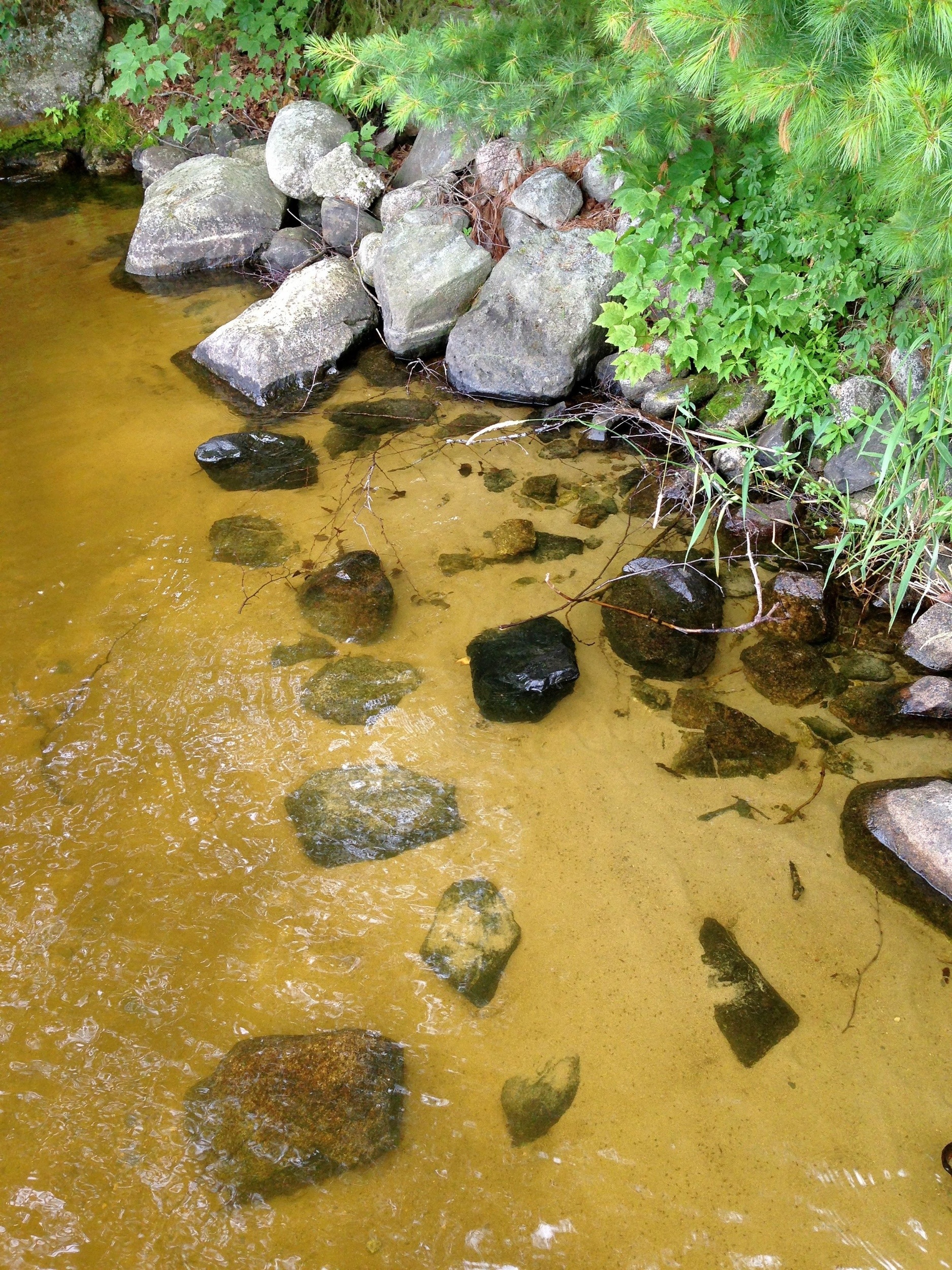
Voyageurs
Spent the day bouncing around the outskirts – and on a couple of trails at Voyageurs National Park. I knew in advance this would be challenging lacking some sort of watercraft but what I discovered is its nearly impossible to explore this place without a boat or kayak or canoe or such. And for that matter the single longest trail in the park – which is a series of islands – is designed for ski mobiles.
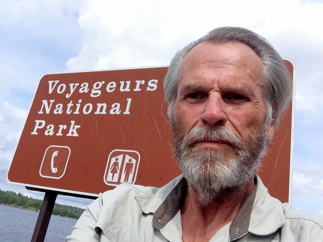 Inasmuch International Falls has a reputation for being the coldest spot in the lower forty-eight that probably makes sense. Come winter you can easily walk to Canada by shortcutting across the frozen lakes and rivers.
 No sign of border fencing up here, either US or CN
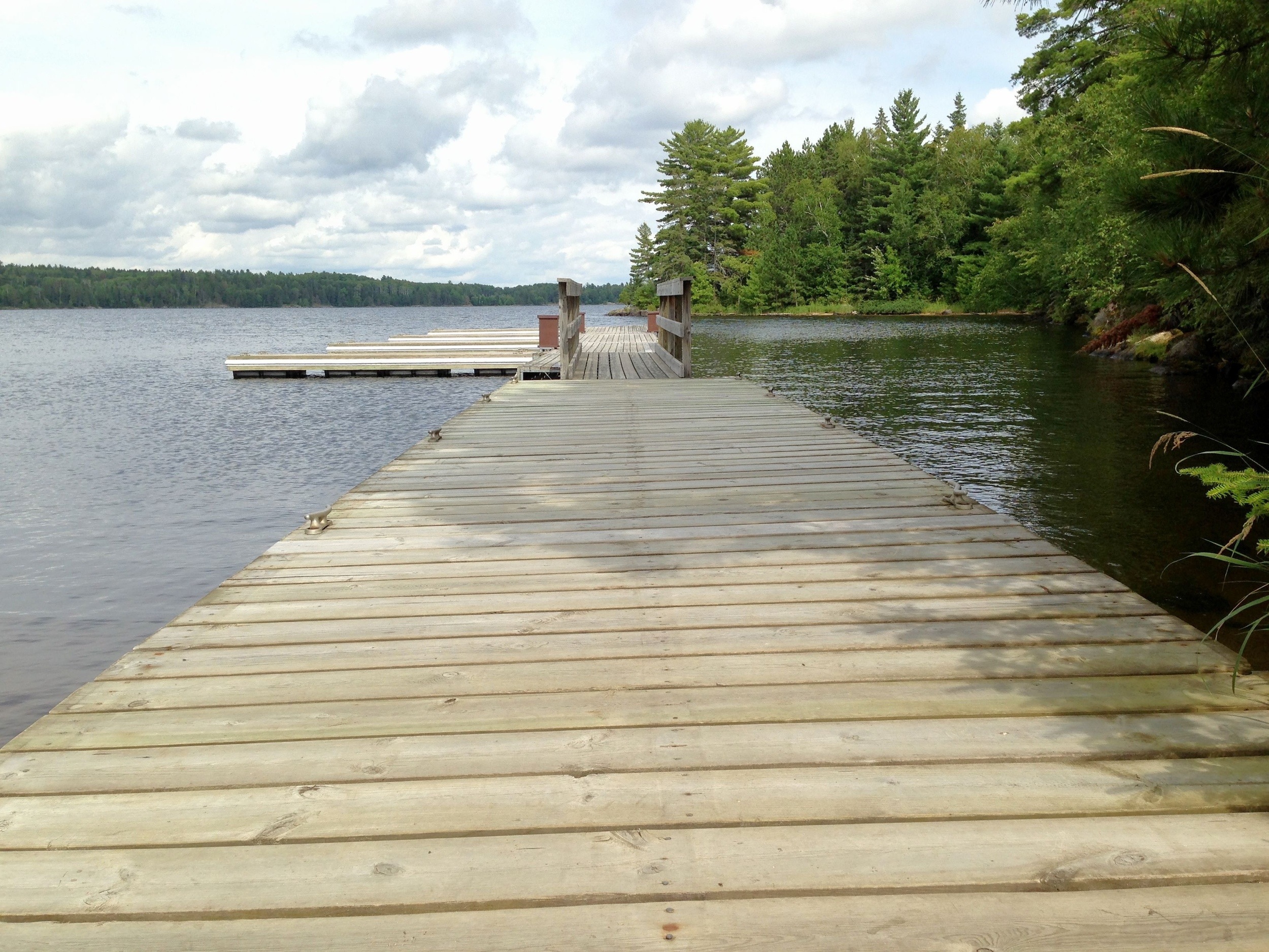 Plenty of water though.
 More than enough to convince me it’s time to move on.
The next stop is Isle Royale National Park in Lake Superior. I’m a little more prepared. I’ve booked passage on a ferry for Thursday morning. This time I’m not going to be left standing on the shore wondering what it’s like on the other side.
Isle Royale is the least visited park in the Continental US. There are probably any number of reasons but certainly the $130/person ferry fee is high on the list. It’s not likely I’ll be paying these places a return visit. But they do get plenty of attention from the local population. If you like to boat or fish or really get close to a herd of moose, this is your kind of place. And if not, well, there are plenty of alternative destinations.
The Wheels Just Keep On Turning
Long haul road-tripping of the type I do is not all campfires and tents and bug spray and romantic things of the sort. It’s true, I get my share of skies that extend from here to there and sunsets that chase them to wherever they feel like going. It’s a good life, no question. Although some people I run into have a hard time believing I don’t get lonely or homesick. I don’t. Trust me on that.
I send cards or letters or emails and such that from time to time contain phrasing to the effect that ‘I wish you were here.’
But really?
Nah.
And it’s not you; its me. I can’t imagine there are too many people who would ever get comfortable with the way I travel. It’s just erratic. Sometimes it drives me a little batty. But as I said in some post – that never got posted – I’m never disappointed. Whatever happens is what’s supposed to happen. Do you have any idea how long it took me to figure that out? And embrace it?
Like today. I’m in Estes Park, CO which sits literally at the gate to Rocky Mountain National Park. I think this is probably one of the top five – by popularity- parks in the country. (Do you know enough about Your parks to guess the other four?) I toured it to a degree this morning. Drove up the Old Fall River Road – a one-way 9 mile stretch of unpaved switchbacks – to the Trail Ridge Rd that peaks out at 12,200 ft and parallels, in a way only engineering marvels of this type can, the Continental Divide.

Just so Chaz couldn’t accuse me of touristing the place I parked at the road peak and walked up 300 ft to the top of the hill. I found just standing up at this altitude to be difficult; I suspect most people could have duck-walked up faster than I got there – but I got there.
Phew!
The widest angle lens on my Canon struggled to capture the vistas. So if this iPhone pic looks anemic Don’t blame Steve Jobs – or me. The park is all about up and boundless. Putting that in pixels ain’t easy although I promise you’ll see a few better images shortly.
But right now I’m on one of those non-romantic runs getting new shoes on the chariot. Drove through a gawdawful rainstorm to get in here last night and experienced hydroplaning at 10,000 ft. Not a good thing. Had the original tires on the car and they had reached the limit at 78000 miles.
I wish I could refresh me as quickly and inexpensively as I did the tires. They just called my name. Job done. Back to Estes.
Capitol Reef
I’ve visited quite a few parks over the last several years but Capitol Reef is by far the most geologically elegant place I’ve ever laid eyes on.
This is the view from my camp for this evening. Can’t wait to explore this place further over the next couple of days.

Eastbound and Down
I arrived in Los Angeles late last October with the idea of spending a few weeks before heading south to Baja for the winter and then working my way back east and home to Virginia. Well, it didn’t quite work out that way. And I’ve been in LA ever since. I’ve yet to change my voting registration and driver’s license but I’ve come to think of this beautiful place as home. For a died-in-the-wool Virginian that’s hard to believe – but it is what it is. Still, there are places back east I need to be in the near future – principally my daughter’s wedding in September – and people scattered between here and there I need to see so next week after dawdling lo these many months in the SoCal sun I begin the long trek eastward.
One of my projects, not that I’m burdened with many, is to visit and photograph each of our National Parks at least once. There are 59 all told and so far I’ve taken in 27. Nine of those by the way are in California, the state which is home to the largest number of national parks. The trip back will consume 37 days primarily because I intend visiting a few more along the way. Eleven in fact. This project gets tougher as the number increases simply because at some point it’s no longer possible to drive to my destination: there are parks in America Samoa, the Virgin Islands and Hawaii. And eight in Alaska!
I’ll figure it out.
For now I thought I’d share the itinerary in word and image:

- 10 July Depart Los Angeles, CA
- 10 – 12 Mono Lake, CA
- 12 South Lake Tahoe, CA
- 13 Ely, NV – Layover Point
- 14 Great Basin NP, Baker, NV
- 14 – 16 Capitol Reef NP, Torrey, UT
- 16 Natural Bridges National Monument, UT
- 16 – 17 Blanding, UT – Layover Point
- 17 Hovenweep National Monument, UT
- 17 – 18 Mesa Verde NP, Cortez, CO
- 18 – 19 Heron Lake State Park, NM
- 19 – 22 Taos, NM – Summer Writer’s Conference
- 22 – 23 Great Sand Dunes National Park, Alamosa, CO
- 23 – 25 Black Canyon of Gunnison NP, Montrose, CO
- 25 – 27 Rocky Mountain NP, Estes Park, CO
- 27 – 28 Wind Cave NP, Custer, SD
- 28 Badlands NP, SD – Stopover
- 28 – 29 Jamestown, ND – Layover Point
- 29 – 31 Voyageurs NP, International Falls, MN
- 31 July – 2 Aug Isle Royale NP, Grand Portage, MN
- 2 – 3 Ironwood, MI – Layover Point
- 3 – 4 Pictured Rocks National Lakeshore, MI
- 4 – 5 Saginaw, MI – Layover Point
- 5 – 6 Parma Heights, OH – Layover
- 6 – 7 Cuyahoga Valley NP, Brecksville, OH
- 7 – 12 Elizabethtown, KY – Layover
- 12 – 14 Great Smoky Mountain NP, Gatlinburg, TN
- 14 – 16 Triad, NC – Layover
- 16 – 17 UVA, Charlottesville, VA
- 17 Aug Arrive Reston, VA
The trip covers a little over 6,000 miles and will consume about 115 driving hours. I’m won’t get to spend as much time in each of the parks as I’d like but I know I’ll get back to many of them over the next several years.
I’m looking forward to visiting my longtime friends and maybe to making a few new ones along the way. More about the wedding later. For now I’ll just say I’m probably looking forward to it as much as any father does when it comes to his one and only (and favorite) daughter. But I’ve known my future son-in-law now for half a dozen years or more and he’s a wonderful young man. I’m sure AnnaSummer will mold him into something workable. 🙂
And next winter? Baja, of course.
10
10
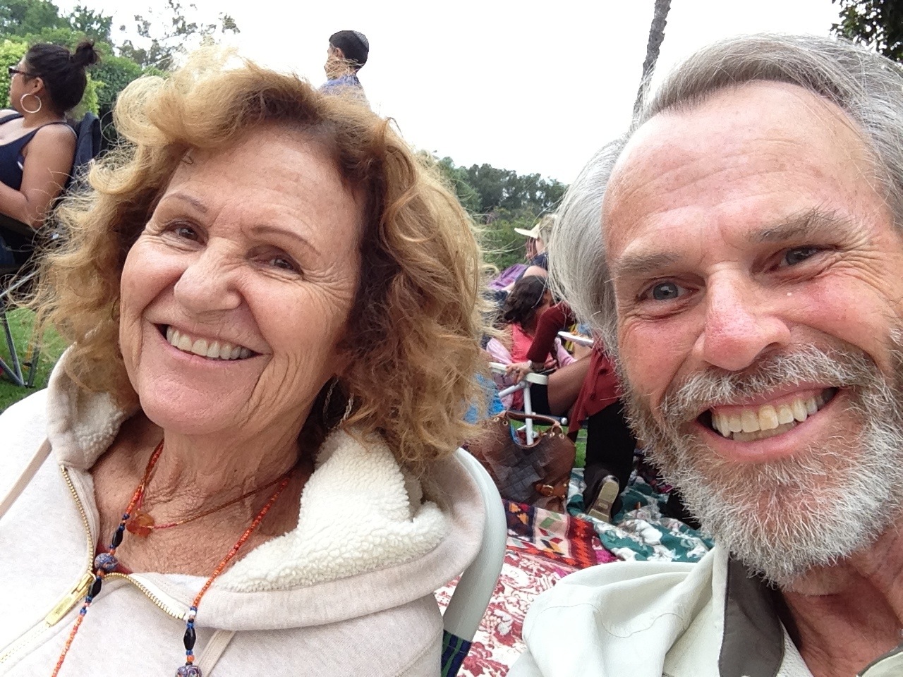
That Annual Sparkly Thing
I suppose at some point we’re going to see some firework displays from our vantage point on the lawn here at Burton Chace Park in the middle of the marina at Marina Del Ray.
The sun’s beginning to disappear over my right shoulder and the pan in front is a combination of yachts cruising in and out the harbor, and long lines of revelers at the half dozen or so porta johns that have been erected along the periphery of the park.
Mitzi and I have staked out a small plot of ground – seems to be shrinking – tossed our shoes and are plotting the destruction of the picnic we assembled at a Subway shop on the way down from Wooster St. There are grills going strong in every direction I look and the mixture of smells is unquestionably delicious but I’m just fine with my turkey breast and banana peppers.
If I manage to actually capture any of the sparkly part of this occasion I’ll try to share, but for now I’m going to go work on the mystery of the disappearing water fountain cross the way.
Enjoy the holiday wherever you may be. And if this is not one of your holidays just be thankful its one of ours and that ‘the generals’ haven’t shown up here since Lee and Grant got together for tea at the courthouse.


10
South Coast Botanic

I’ve come to find that Groupons lead me to places I might otherwise not find, or not find so easily. That’s certainly the case with South Coast Botanic. It popped up on a daily deal a couple of weeks back offering a one year family membership for $20. I’ve really come to enjoy visits to botanic gardens and arboretum so I took the deal.
It was a very good decision. For one, as you’ll see, this is an extremely well-presented garden and well worth the price of admission. As it is that $20 will allow for visits throughout the seasons – such as they are here in SoCal – for the next twelve months.
And a Bonus! It seems there are 23 reciprocating gardens located here in California and over a hundred throughout the country. My membership is good for all of them. If you’re in the area you might want to look into this. With or without a Groupon it’s hard to beat.
International Readers: Google “Groupon” 🙂
A Touch Of Tahoe
I had really hoped to catch up on a weeks worth of shooting today. I’ve covered a lot of territory and have more to explore before reaching home base on Friday. Two days in San Francisco that included lunch with my brother Pat and a Google + Photo Walk led by Dave Powell and Chris Cabot. Then a short drive by Pt Reyes that consumed nearly an entire day. And last night a trip up to Tahoe through a driving snow storm. Phew!
And we’re only half way.
So let me throw some iPhone pics at you for now and get some other stuff later.

This is Emerald Bay near South Lake Tahoe. The island is called the Tea House.
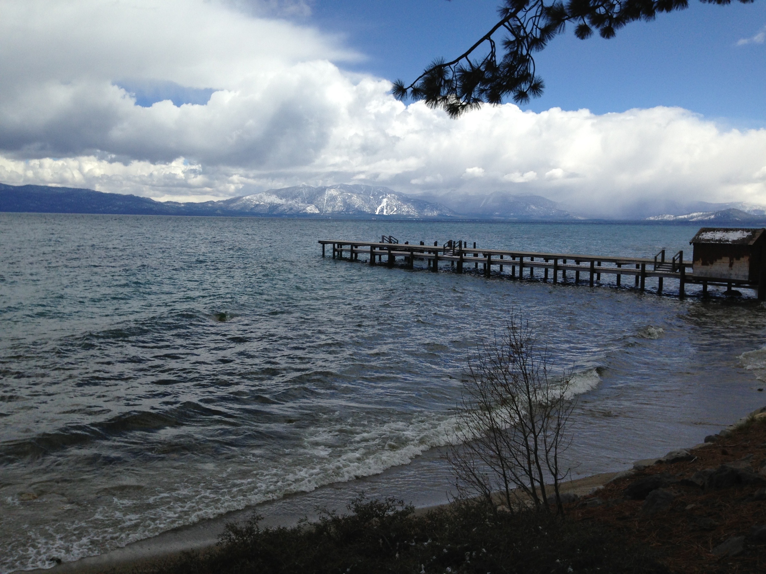
The pier at Sugar Pine Point State Park.

King’s Beach Launch Area
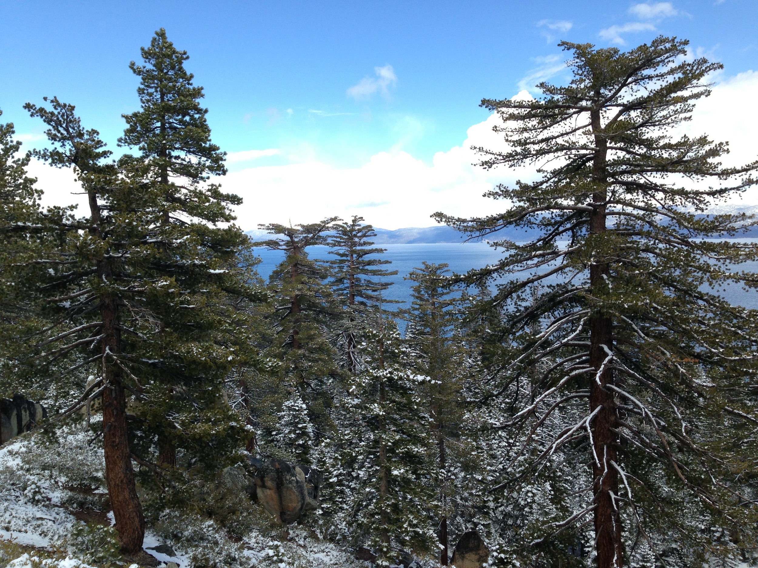
The most common view of the Lake as you circle it is through gorgeous evergreen stands like this one.
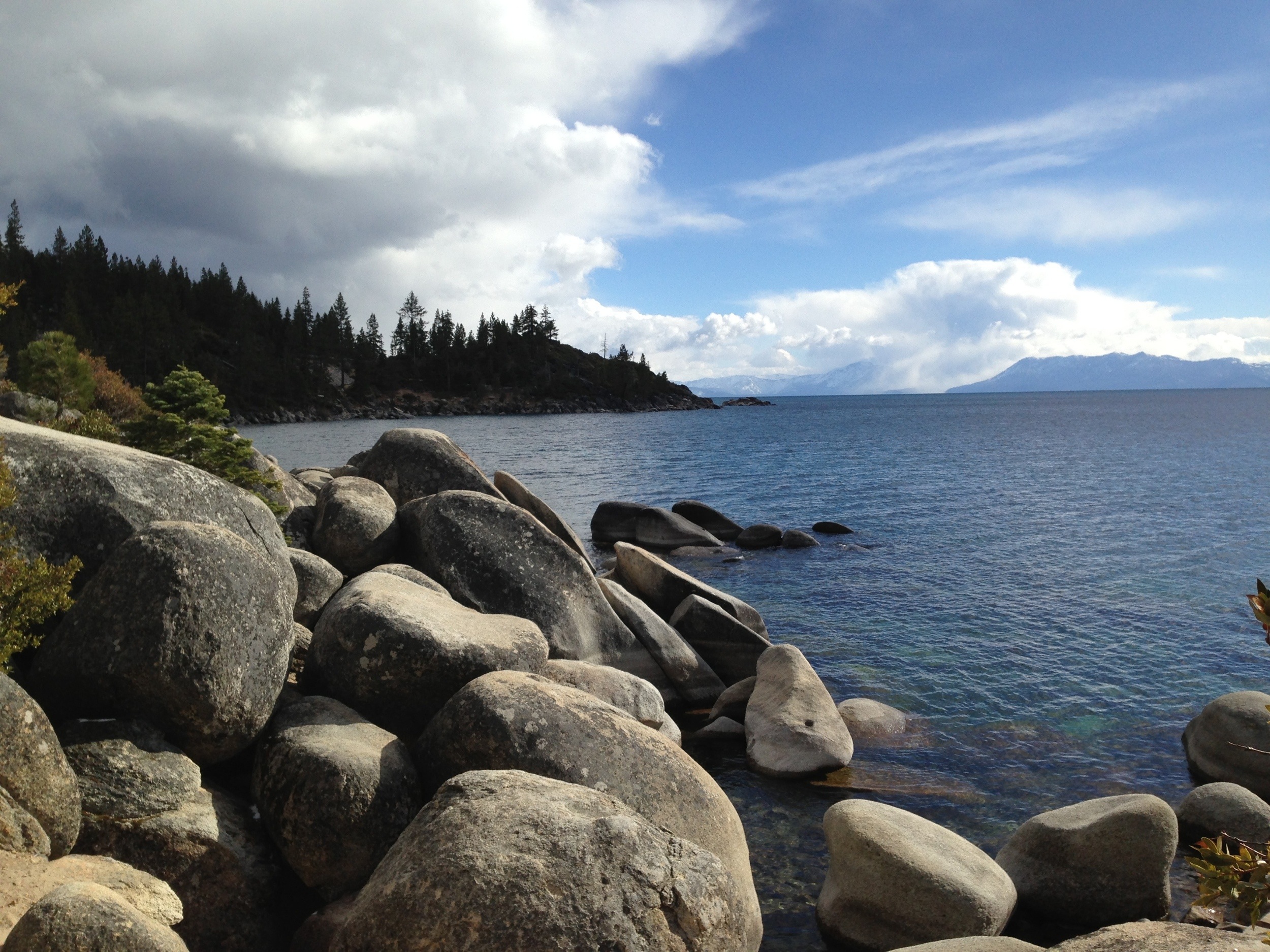
And finally a rocky out cropping near Memorial Point on the Nevada side.
