I was helping a friend set-up a new blog this morning and in the process forget how much effort it took; how much time I’d spent setting this one up. I also exposed myself to the WordPress tool-set for the first time in months and found it had undergone remarkable improvement in ease of use since last I had occasion to visit. Even so , Continue reading
Tag Archives: Road Trip
House on the River Bluff
Belle Grove Plantation at Port Conway, King George, VA
Birthplace of James Madison and a Premiere B&B hosted by Michelle and Brett Darnell. A verifiable gem of a place backed by genuinely passionate people.

Belle Grove Plantation at Port Conway


Michelle Preparing the Breakfast Setting

Sunset on the Rappahanock


10
10
10
10
10
Glen Canyon Crossing

Glen Canyon Crossing
10
Coming or Going?

So, we’re all standing around in the evening near South Pond in Bosque del Apache NWR waiting for the Sand Cranes to return from whence they departed earlier in the day – way earlier!
We waited. And waited. And waited. But instead of the thousands that had taken off earlier, we had tens trickling back in. And then the train came by.

The sun set. The moon rose. And a few of the cranes graced the horizon
10
10
10
10
Chiricahua National Monument
A few shots from Chiricahua National Monument near Willcox, AZ.

Sunset from Massai Point
10
10
10
10
10
Ochlockonee Bay, Florida
Caught this on the expanse between Tallahassee and Panama City, Florida. It was a battle between me and the mosquitoes but I think I won.

10
10
10
10
10
10
10
10
10
It Was A Day For Rocks
If you click the photograph you’ll see what I mean.
Taken mostly near Cade’s Cove in Great Smoky Mountain National Park although toward the end you’ll notice a few I along the Blue Ridge Parkway in North Carolina

10
Fine Wine
I had just about reached the end of my first day along the Blue Ridge Parkway; the sun was setting; I could simply not find a shot I liked.
Then this vineyard appeared out of nowhere.

10
Brandywine Falls
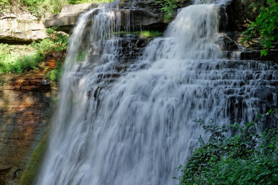
I had the opportunity to visit Cuyahoga Valley National Park last week and its Brandywine Falls of which I had snapped an iPhone photo and posted on Facebook. It received quite a bit of positive feedback so I thought you might also enjoy one of the photographs I captured with my Canon DSLR.
10
Au Sable Point – Pictured Rocks National Lakeshore
I suppose the real cause of my all night drive from Pictured Rocks National Seashore resulted from my dalliance along the Au Sable Point Trail. I had seen the Au Sable Light from a vantage point along the dunes about five miles north near Grand Marais and decided I needed to get a closer look. It’s reached by a trail located just off the north perimeter of the Lower Campground, about a mile and a half from the lighthouse, so when I finished up tramping around the dunes I drove down that way.
By the time I reached the trailhead it was 1930. I calculated the walk would require 30 minutes one way and given that I’m still way north (46 degrees) I’d have plenty of time to get out there do some photography and get back before dark. I was thinking about the Light not the sunset and relished the idea that for once I would be approaching my subject both at the right time of day and under near perfect weather. One of those rare times when my schedule coincided with the right everything.
The Lower Campground is hard by the lakeshore. I parked and proceeded up the path. It runs parallel to the and within feet of the shoreline providing a panoramic view of Lake Superior. As I trudged along it occurred to me that in addition to the Lighthouse I might also be able to capture shots of the sunset over the lake.
I took my time at the Light and shot it from as many angles as I could. It has stood on the point since 1874 and is one of tens such lights found around the Great Lakes area. If you’re into light houses this is the place to be – much more so than on the east or west coastlines. The shots will be the subject of the next post because I was more taken – at least for now – by what followed that part of the shoot.
I finished up, working my way around a few late evening visitors who arrived in time to clutter up the view, and headed back down the trail at a quick pace. I planned on finding a spot on the beach near where I had parked the car and taking in the ending of the day. I arrived about 2030 and looked around for a spot. It was then I also realized that I had plenty of time to run and get my tripod – always a last-minute and usually overlooked thought – as well as a lens filter that would help to cut the sun’s glare and capture more of its coloration. So I picked the items up and headed back to the beach.
I was surprised to see that just left of the place at which I entered the beach a creek was flowing into the lake at moderate to high velocity so I settled on a spot that placed its exit point between me and the sunset. The lens filter ( a variable Tiffen) allowed me to soften the sun’s rays and to slow the movement of the water. I really loved the results.
Click on the photograph to see the several different shots that are in the SmugMug Gallery

10
10
Now What?

Eastbound and Down
I arrived in Los Angeles late last October with the idea of spending a few weeks before heading south to Baja for the winter and then working my way back east and home to Virginia. Well, it didn’t quite work out that way. And I’ve been in LA ever since. I’ve yet to change my voting registration and driver’s license but I’ve come to think of this beautiful place as home. For a died-in-the-wool Virginian that’s hard to believe – but it is what it is. Still, there are places back east I need to be in the near future – principally my daughter’s wedding in September – and people scattered between here and there I need to see so next week after dawdling lo these many months in the SoCal sun I begin the long trek eastward.
One of my projects, not that I’m burdened with many, is to visit and photograph each of our National Parks at least once. There are 59 all told and so far I’ve taken in 27. Nine of those by the way are in California, the state which is home to the largest number of national parks. The trip back will consume 37 days primarily because I intend visiting a few more along the way. Eleven in fact. This project gets tougher as the number increases simply because at some point it’s no longer possible to drive to my destination: there are parks in America Samoa, the Virgin Islands and Hawaii. And eight in Alaska!
I’ll figure it out.
For now I thought I’d share the itinerary in word and image:

- 10 July Depart Los Angeles, CA
- 10 – 12 Mono Lake, CA
- 12 South Lake Tahoe, CA
- 13 Ely, NV – Layover Point
- 14 Great Basin NP, Baker, NV
- 14 – 16 Capitol Reef NP, Torrey, UT
- 16 Natural Bridges National Monument, UT
- 16 – 17 Blanding, UT – Layover Point
- 17 Hovenweep National Monument, UT
- 17 – 18 Mesa Verde NP, Cortez, CO
- 18 – 19 Heron Lake State Park, NM
- 19 – 22 Taos, NM – Summer Writer’s Conference
- 22 – 23 Great Sand Dunes National Park, Alamosa, CO
- 23 – 25 Black Canyon of Gunnison NP, Montrose, CO
- 25 – 27 Rocky Mountain NP, Estes Park, CO
- 27 – 28 Wind Cave NP, Custer, SD
- 28 Badlands NP, SD – Stopover
- 28 – 29 Jamestown, ND – Layover Point
- 29 – 31 Voyageurs NP, International Falls, MN
- 31 July – 2 Aug Isle Royale NP, Grand Portage, MN
- 2 – 3 Ironwood, MI – Layover Point
- 3 – 4 Pictured Rocks National Lakeshore, MI
- 4 – 5 Saginaw, MI – Layover Point
- 5 – 6 Parma Heights, OH – Layover
- 6 – 7 Cuyahoga Valley NP, Brecksville, OH
- 7 – 12 Elizabethtown, KY – Layover
- 12 – 14 Great Smoky Mountain NP, Gatlinburg, TN
- 14 – 16 Triad, NC – Layover
- 16 – 17 UVA, Charlottesville, VA
- 17 Aug Arrive Reston, VA
The trip covers a little over 6,000 miles and will consume about 115 driving hours. I’m won’t get to spend as much time in each of the parks as I’d like but I know I’ll get back to many of them over the next several years.
I’m looking forward to visiting my longtime friends and maybe to making a few new ones along the way. More about the wedding later. For now I’ll just say I’m probably looking forward to it as much as any father does when it comes to his one and only (and favorite) daughter. But I’ve known my future son-in-law now for half a dozen years or more and he’s a wonderful young man. I’m sure AnnaSummer will mold him into something workable. 🙂
And next winter? Baja, of course.
10
10
Sunrise Near Dickinson, ND

Hard by The North Dakota Badlands
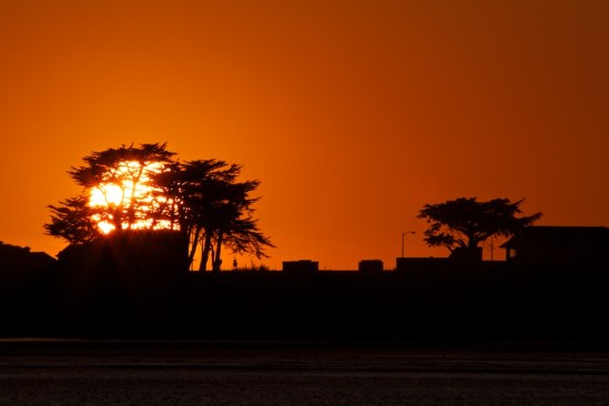
Crescent City Sunset
Sunset At Pt Dume State Park, Malibu

On 12 Jan Mitzi and I went to the first major west coast exhibition of the Kelly Collection of American Illustration Art (thekellycollection.org) at the Weisman Museum at Pepperdine University. By invitation of the collection owner I might add. The opening reception ran from 5-7 to be followed by dinner at a restaurant a few miles up the coast. We over-estimated traffic and arrived early so I drove up the PCH to make sure I knew the restaurant’s exact location. As it turned out it was on the entrance road to the Park. So we drove out to the beach to see what we could see. Now you can see what we saw.
10
10
Sunrise – Moonset – Sand Dunes
One of the things I had been looking forward to on my recent camping trip to Death Valley – also my first visit – was seeing the night sky from one of the darkest places on earth. Being an eastern urbanite that sky is something that I am otherwise routinely deprived of. I wasn’t fully aware of the depths of my deprivation until one summer night sitting outside my dwelling in Arroyo Seco, near Taos, I glanced up and really saw the Milky Way for the first time. It was almost as if I were looking at the underside of a very sparkly lid – it was that tangibly imposing to me. I had been in a few planetariums in my life and in a few dark areas; but nothing I ever saw displayed in any of them came close to looking at the real thing hanging there over my head that night. So, I figured this would be one of the many treats to expect in the Valley. A super dark sky and a big ol Milky Way.
Typically, I paid no attention to the state of the sky before arriving. I just go. I thought I would see exactly what I intended to see: A gazillion stars spread out endlessly across the night sky. The moon had different plans and for most of my stay was up early shining like a flood light and not setting until late the next morning. But even had I done the research ahead of time my visit schedule wasn’t going to change. Fortunately I’m going to be under wide open western skies for some time and the Valley is only a short 5 hour drive from my base camp in Los Angeles. There will be other chances, assuming the Mayans weren’t hiding the real date somewhere.
I went with what I had and since I had to be up early for sunrise lighting I was also able to get moonsets. I suppose I could have done the moonrise but when it’s full like this it’s very difficult to acquire any contrast on its face and a moon without contrast just looks like – well, a big flood light. Nothing especially interesting about that.
I already posted one of my Zabriskie shots on Google+ in the Death Valley Photographers Community – a part of which I now count myself, but nothing’s come through the blog yet so here you have a sunrise scene that I took from the top side of the Texas Springs campground area – nice when the shots come to you – and then a shot of the moon setting on the western side of the Valley over the Panamint Range. These were shot on different days because the sunrise shots I got from the Zabriskie overlook just didn’t work. (I feel as if I’m lucky when any of them turn out.)

I also have to admit that this sunrise caught me by surprise. I was a little late getting out of the tent on this morning and hadn’t expected to see anything other than a bright morning sky. The gear was locked in the car. The camera had no lens mounted. So I had to scramble. Hand held. The shutter was a little on the slow side to get the image and it suffered as a result from a lack of sharpness. But still. I can’t remember the last time I saw so much sunfire in the morning sky. It is what it is. And that ‘is’ works for me.

I was more prepared for the moonset and I like the result. The geology and the astronomy that manifest their ways in Death Valley make it a wondrous place. This Valley certainly earned its name. It holds the bones of many men and animals who arrived in its depths at the wrong time and became permanent footnotes in its long and violent history. Even today taking anything in this place for granted can cost you your next sunrise – all your next sunrises. No matter. It is a visual delight and one of the grandest exhibitions Nature puts on anywhere on earth.
Since I’ve been recalcitrant in getting any of the première shots online let me add one more; this of the Mesquite Sand Dunes near Stovepipe Wells. I’m sure as people make return trips to DV that favorites places established in earlier visits become replaced by new ones that hadn’t quite resolved for them earlier. This place is simply too grandiose (is that redundant?) for anyone to make a selection for all time. But they can one at a time – and I did. The Dunes. They are mesmerizing. They are also easy to get lost in if you fail to hold the high ground. I posted a couple of videos on Facebook of my walking round these piles of sand and acquired a pretty spiffy self-portrait that is posted in the Selfy-Sunday Group on Google +. This shot is my favorite – so far. It’s a soft exposure and I just like the way so many of the colors that define this place blend together in it.

This was taken late morning and so the light here is also from the sunrise. The area in the foreground I think is referred to as The Devil’s Corn Field but I’m not entirely sure. If it weren’t so late and if I weren’t so lazy, I’d look it up. As it is, if you’re really curious – or perhaps know – you can chime in.
This
10
10
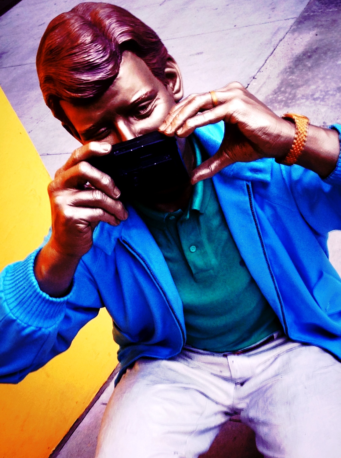
A Wonderful Day In The Neighborhood
Took the opportunity today to just go out and walk around the neighborhood a little to see what I might find. The highlight of the outing for me was watching a woman come out of a store and immediately go to war with the door of her Land Rover which apparently was not cooperating with her remote device. This went on for about 30 seconds or so. Then something caught her eye: the identical black Land Rover parked immediately behind the uncooperative one. The remote seemed to be ok with that one. Away she went.
l have to tell you that walking around this particular neighborhood can be a little intimidating. The most popular auto brand on the street is Mercedes. It’s also the low end brand, or at least vies with Lexus for the dubious distinction. Lamborghini’s and Maserati’s? Sure. But you can also pick up a shiny new McClaren on this street.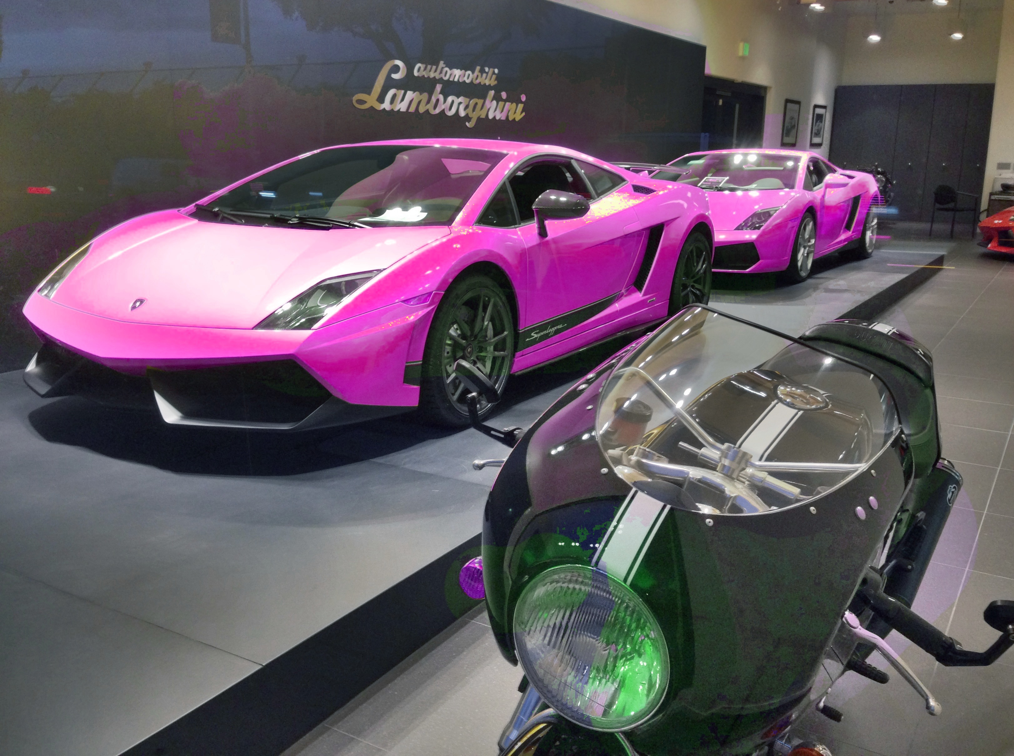
In fact you’d probably be able to get one of those long before you’d find a cab ’round here. I saw three or four in the course of a two hour stroll. Fortunately we have Uber.
I did manage to get a few iPhone shots- which is what I had in mind, Today is 12-12-12 and I had signed up on Google+ to contribute a photograph to the event. Some six hundred others also signed up but I said I’d be there so…..

We have lots of little alleyways along Robertson and a few along Rodeo and Canon. reminds me of Paris except that these pathways are not so extensive or grand. Here we have the entrance to the Beverly Players theater and then the rather long entrance to something called Super Vision. You need good eyes to see to the end.

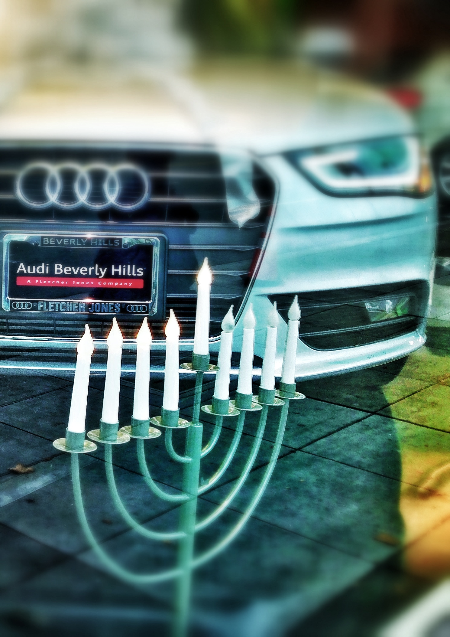
Christmas decorations are up around the Hills but we’re also into the fourth day of Chanukah and decorations honoring the holiday are visible in lots of the shops around the hood.
Cars caught my eye today since there are lots of them and quite a few that you’d rarely see elsewhere. Take this Mercedes Formula Racer for instance – sponsored by an old friend of mine:
This is a DUI sitting stock still, no?
I also ran across a vintage favorite sitting on the backlot of an establishment called Auto Doctors. I guess it wasn’t feeling well.
Looks good though, don’t you think?
Rodeo Drive is the better known street here but it’s paralleled by Canon Drive which is to food what Rodeo is to clothes. Even the Pizzeria has valet parking. As I was walking up one side of Canon I noticed a photographer on the opposite side of the street taking pictures of some street sculpture and made a note to check it out on my way back. It turned out that the photog was also street sculpture.

I got in on the act.
A couple blocks further and I ran across a slightly different sort of sculpture adorning the entrance to a public parking lot – next to a Private Client Chase Bank. So, are these rocks coming or going? And what’s a Private Client Bank anyway?

The best shots of the day were of the opposite sides of a fountain in the entrance courtyard to an office building I passed.

This corner gift shop had one of the most attractive awnings I’ve run across here or anywhere.

And although they don’t get a lot of publicity the residential parts of this area – the un-gated, 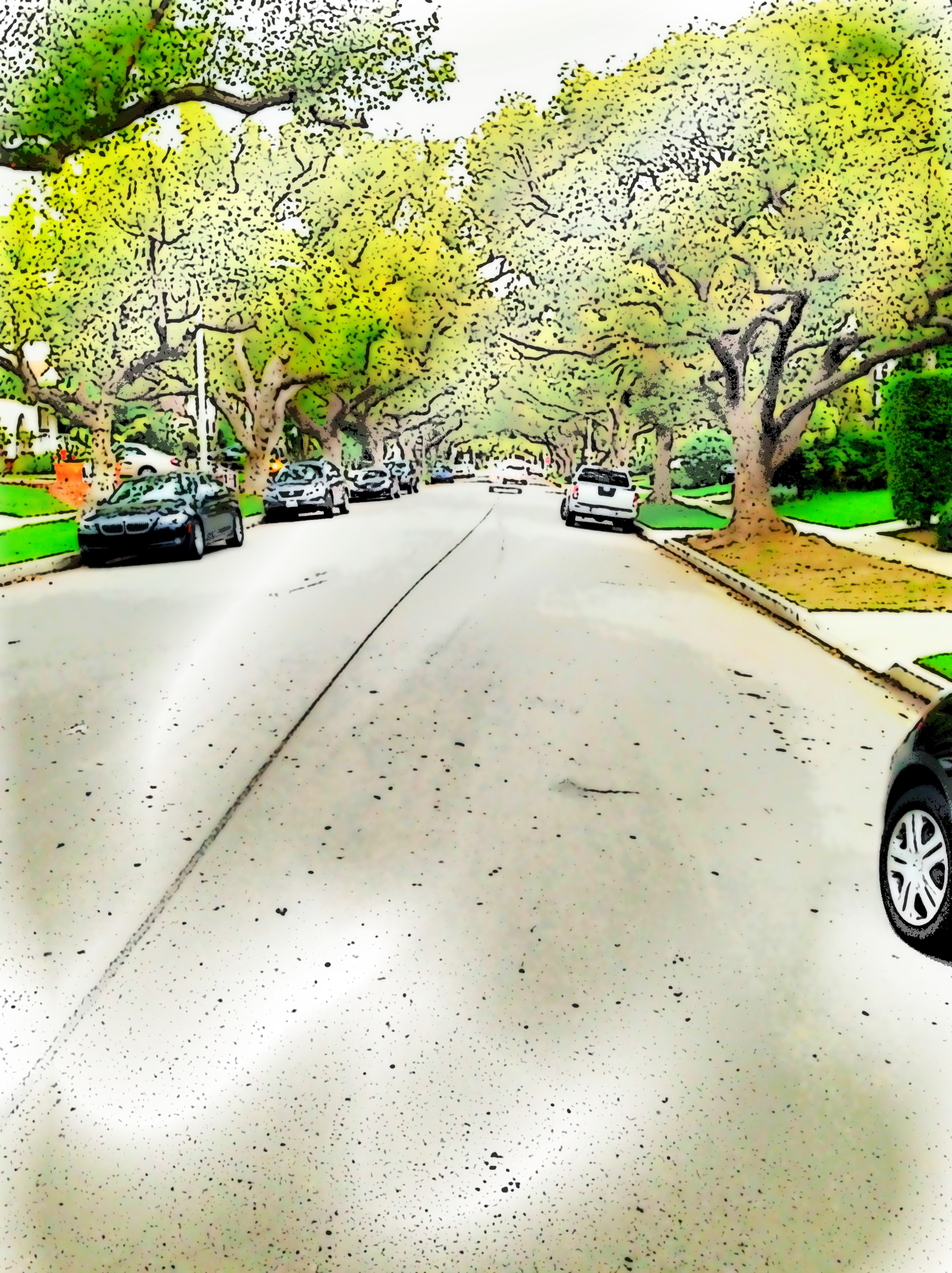
normals areas – are all but pastoral.
I walked past one building that I found particularly attractive in a art deco-ey way and spent some time after I returned home recasting it with some of the iPhone apps i’ve collected. Here’s the series.
What follows is a combination of edits performed with Luminance, Mobile Monet, Color Blast, Paint FX, PhotoCopier, and 100 Cameras.
This final version also incorporates an Instagram filter – Kelvin I think. Pretty cool huh?
For those of you who have been asking about the work done in Death Valley – be patient, we’re almost there. Will be up soon.
10
Dante’s View Redux
Dante’s View is about 6000 ft above the bottom of Death Valley’s lowest point – 287 ft below sea level. I am about 500 feet above the point. Much too high for me. But WTF. This caps off a long day trekking round the desert. Getting cold up here. Later

 DeathValley
Project 365 – Day 37

Ogden. I suppose by now you’ve figured out there are some gaps in my Project 365 photo posts. It seemed simple to adhere to this schedule but I’ve found it more rigorous that I had imagined. So, I’ll get them up in numerical order but there probably not one every single day.
What you see here is a crypt in the Fairview Cemetery on the outskirts of Bowling Green, KY. I visited there last Veteran’s Day near the end of the long 2011 road trip. I seem to spend a lot of time in cemeteries. Occasionally they make good subjects because of the stories that can be constructed from the stones.
Cemeteries were on my mind today. Their residents are the only ones completely exempt from tax of any sort in this country. But in some parts of the country they have been known to vote. 🙂
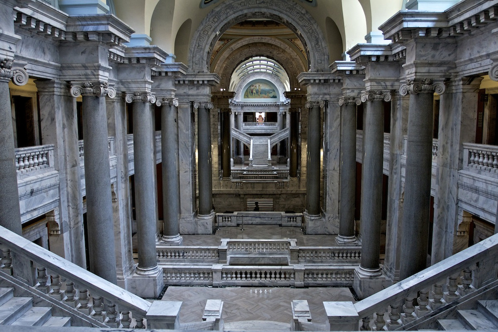
More of the Kentucky Rotunda
One of the first places I had the opportunity to visit week before last in KY was the Capitol Building in Frankfort. We were there because my host, David Toczo, was participating in a photographic art exhibit. He had had two pieces juried in. The display was in the Rotunda. After the remarks and handshakes by and with Jane Beshear, the Commonwealth’s First Lady, we wandered round the building and I managed to capture a few photos. I sent one of these up by iPhone on that day but would like to share a few more that I took with the Canon.
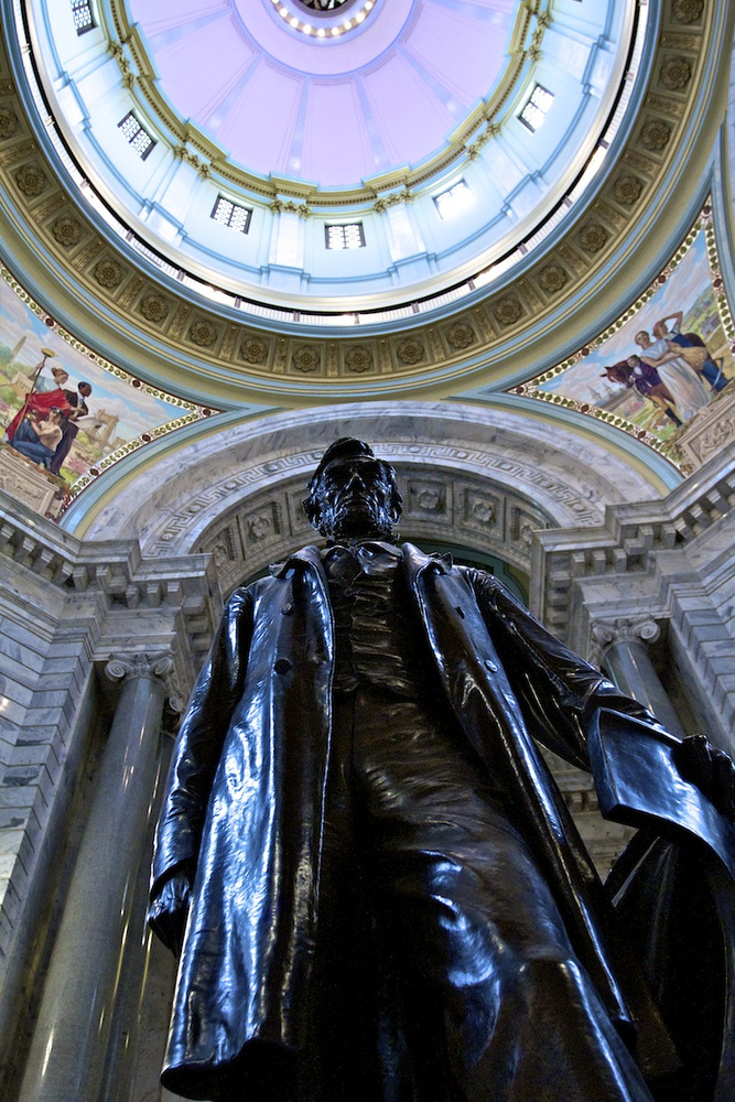
The first is of the bronze statue of Lincoln that stands in the center of the Rotunda floor. It’s impressive in and of itself but when viewed with the Rotunda interior in the background becomes even more so. Illinois is the state in which Lincoln was raised and which served as his political launching point but as any true Kentuckian call tell you, he was born in Hardin County, KY. Incidentlally, his grandfather had migrated there from Virginia and for that matter Kentucky’s “Commonwealth” status stems from its having been spawned from the western reaches of Virginia.
The Commonwealth’s representatives were not in session on this particular afternoon so I got to stick my head into the Senate Chamber. About the same time a guide/docent came by and wanted to know if I had any questions. I had already counted the seats in the room (actually I counted the computer screens at the desks) so I asked her how many senators there were. Her response, “38”, matched my count. I sensed that she would like a few more questions thrown her way but none came immediately to mind. So we thanked her and moved on. I should have asked her who designed the room and its surrounding building. The answer by the way is Frank Mills Andrews (thank you Wikipedia)
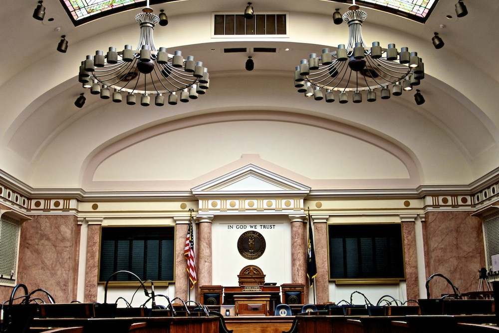
Andrews’ beaux-arts creation is a major improvement over the Greek style of the Old Capitol Capitol Building across the street.
First Ever Press Creds

Thanks to David Toczko and Lone Dakota Photography!
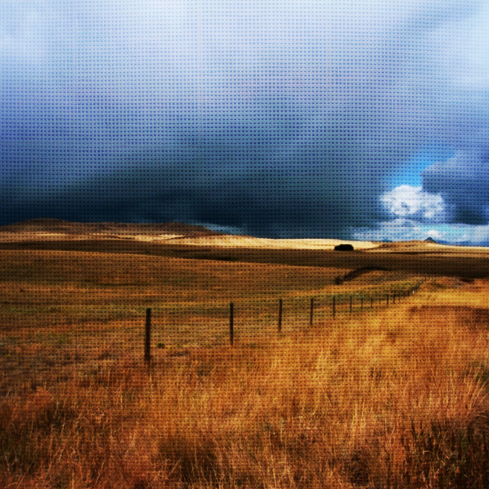
Big Sky
-rgh
Sent from my iPhone
The Perfect Guest

KC the Cocker Spaniel – She’s a wonderful companion. And a great road-tripper.
The Trip – Follow The Little Red Dots
This map image isn’t exactly correct, I did not visit WA State or FL, but it’s close in every other regard. I hadn’t really been paying attention to this geo-tagging but if you take a picture along the way from time to time and integrate them with a Google map, this is what you get.
The first time I saw one of these was when Chaz and his buddy Tom did their trip from VA to WA for Chaz to check in at Ft Lewis after his return from the Middle East. That was in 2009. It’s a liitle easier to do now, else you wouldn’t be seeing this. 🙂
Those two errant dots are there becasue there are a couple of photos lost in the pile that weren’t taken on this trip and I just don’t feel like ferreting them out. Pretend you didn’t see them. I guess I should also note that I was in Cleveland to visit Wendy Oliver but failed to take an iPhone pic there that I kept. Maybe next time.
Oh, yes. The way you read this is from east to west and back where the out-going route is through KY and from there up into SD.

