I was helping a friend set-up a new blog this morning and in the process forget how much effort it took; how much time I’d spent setting this one up. I also exposed myself to the WordPress tool-set for the first time in months and found it had undergone remarkable improvement in ease of use since last I had occasion to visit. Even so , Continue reading
Tag Archives: National Parks
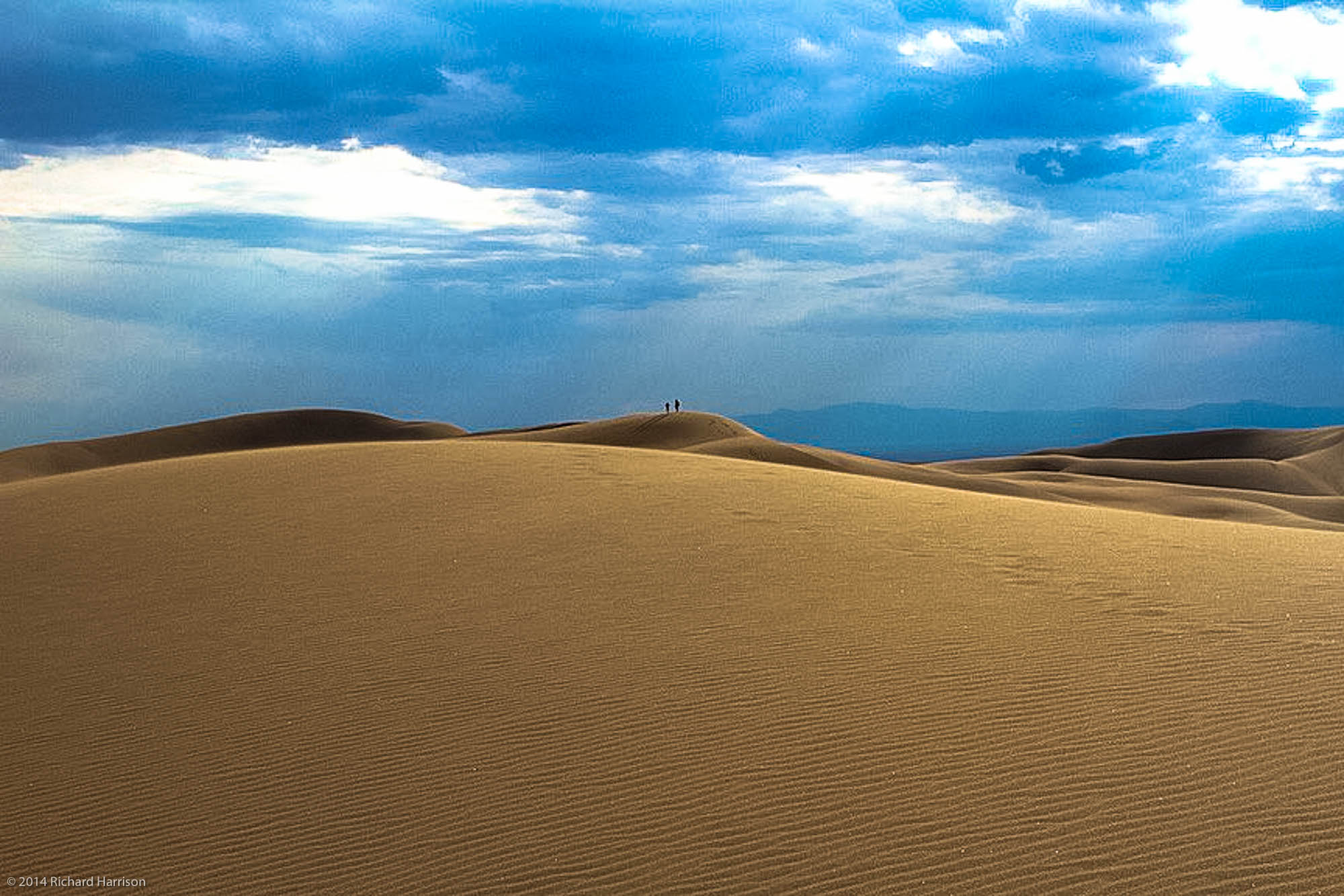
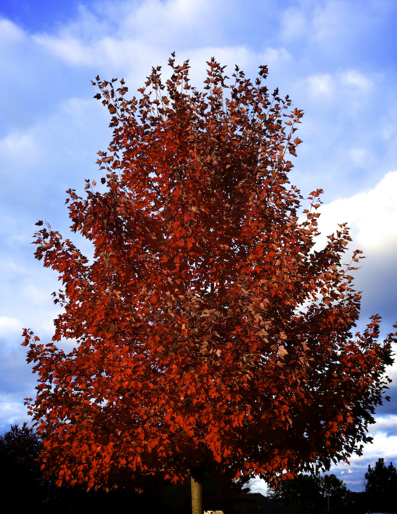
Great Sand Dunes National Park
And then a few minutes later the storm hit…..
Sometimes the trail can be difficult to find but it’s almost always a rewarding search
10
10
Bright Angel
A bird’s eye view of the Bright Angel Trail, Grand Canyon National Park, AZ, USA

Eastbound and Down
I arrived in Los Angeles late last October with the idea of spending a few weeks before heading south to Baja for the winter and then working my way back east and home to Virginia. Well, it didn’t quite work out that way. And I’ve been in LA ever since. I’ve yet to change my voting registration and driver’s license but I’ve come to think of this beautiful place as home. For a died-in-the-wool Virginian that’s hard to believe – but it is what it is. Still, there are places back east I need to be in the near future – principally my daughter’s wedding in September – and people scattered between here and there I need to see so next week after dawdling lo these many months in the SoCal sun I begin the long trek eastward.
One of my projects, not that I’m burdened with many, is to visit and photograph each of our National Parks at least once. There are 59 all told and so far I’ve taken in 27. Nine of those by the way are in California, the state which is home to the largest number of national parks. The trip back will consume 37 days primarily because I intend visiting a few more along the way. Eleven in fact. This project gets tougher as the number increases simply because at some point it’s no longer possible to drive to my destination: there are parks in America Samoa, the Virgin Islands and Hawaii. And eight in Alaska!
I’ll figure it out.
For now I thought I’d share the itinerary in word and image:

- 10 July Depart Los Angeles, CA
- 10 – 12 Mono Lake, CA
- 12 South Lake Tahoe, CA
- 13 Ely, NV – Layover Point
- 14 Great Basin NP, Baker, NV
- 14 – 16 Capitol Reef NP, Torrey, UT
- 16 Natural Bridges National Monument, UT
- 16 – 17 Blanding, UT – Layover Point
- 17 Hovenweep National Monument, UT
- 17 – 18 Mesa Verde NP, Cortez, CO
- 18 – 19 Heron Lake State Park, NM
- 19 – 22 Taos, NM – Summer Writer’s Conference
- 22 – 23 Great Sand Dunes National Park, Alamosa, CO
- 23 – 25 Black Canyon of Gunnison NP, Montrose, CO
- 25 – 27 Rocky Mountain NP, Estes Park, CO
- 27 – 28 Wind Cave NP, Custer, SD
- 28 Badlands NP, SD – Stopover
- 28 – 29 Jamestown, ND – Layover Point
- 29 – 31 Voyageurs NP, International Falls, MN
- 31 July – 2 Aug Isle Royale NP, Grand Portage, MN
- 2 – 3 Ironwood, MI – Layover Point
- 3 – 4 Pictured Rocks National Lakeshore, MI
- 4 – 5 Saginaw, MI – Layover Point
- 5 – 6 Parma Heights, OH – Layover
- 6 – 7 Cuyahoga Valley NP, Brecksville, OH
- 7 – 12 Elizabethtown, KY – Layover
- 12 – 14 Great Smoky Mountain NP, Gatlinburg, TN
- 14 – 16 Triad, NC – Layover
- 16 – 17 UVA, Charlottesville, VA
- 17 Aug Arrive Reston, VA
The trip covers a little over 6,000 miles and will consume about 115 driving hours. I’m won’t get to spend as much time in each of the parks as I’d like but I know I’ll get back to many of them over the next several years.
I’m looking forward to visiting my longtime friends and maybe to making a few new ones along the way. More about the wedding later. For now I’ll just say I’m probably looking forward to it as much as any father does when it comes to his one and only (and favorite) daughter. But I’ve known my future son-in-law now for half a dozen years or more and he’s a wonderful young man. I’m sure AnnaSummer will mold him into something workable. 🙂
And next winter? Baja, of course.
10
10
Scotty’s Garage

Scotty’s Garage
10
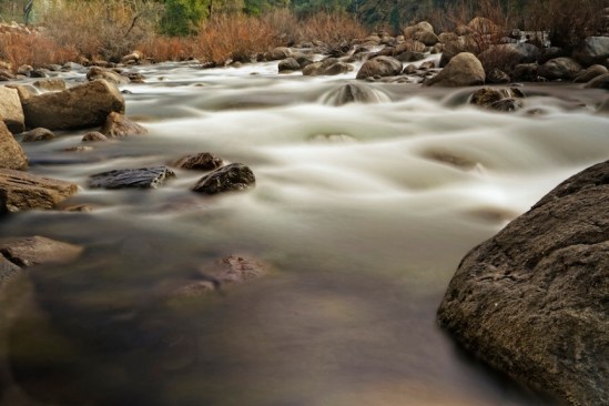
Along Merced Creek
On the outskirts of Yosemite Valley
Icons
Here’s a couple of photographs that so far as I know I haven’t posted anywhere. The first: Mt Whitney, at 14,505 feet the tallest peak in the lower 48. Just a touch of snow at the time – early December 2012.

I like it. But I had not gone into the Alabama Hills that morning to shoot Whitney. I was after a shot of another icon, the Möbius Arch, the signature natural landmark in the Hills.
I was out early and was lucky enough to run into two other photogs who were skilled and who had been there before. So I followed their moves. That’s how I got not only my best Arch shot but in process managed an image of an icon within an icon. The peak to the left which appears to be higher – and isn’t- is Lone Pine Peak.

Anyway.
It’s my shot but I’d never have gotten it without help from Bernie and Jim. Thanks guys!
10
Sunrise – Moonset – Sand Dunes
One of the things I had been looking forward to on my recent camping trip to Death Valley – also my first visit – was seeing the night sky from one of the darkest places on earth. Being an eastern urbanite that sky is something that I am otherwise routinely deprived of. I wasn’t fully aware of the depths of my deprivation until one summer night sitting outside my dwelling in Arroyo Seco, near Taos, I glanced up and really saw the Milky Way for the first time. It was almost as if I were looking at the underside of a very sparkly lid – it was that tangibly imposing to me. I had been in a few planetariums in my life and in a few dark areas; but nothing I ever saw displayed in any of them came close to looking at the real thing hanging there over my head that night. So, I figured this would be one of the many treats to expect in the Valley. A super dark sky and a big ol Milky Way.
Typically, I paid no attention to the state of the sky before arriving. I just go. I thought I would see exactly what I intended to see: A gazillion stars spread out endlessly across the night sky. The moon had different plans and for most of my stay was up early shining like a flood light and not setting until late the next morning. But even had I done the research ahead of time my visit schedule wasn’t going to change. Fortunately I’m going to be under wide open western skies for some time and the Valley is only a short 5 hour drive from my base camp in Los Angeles. There will be other chances, assuming the Mayans weren’t hiding the real date somewhere.
I went with what I had and since I had to be up early for sunrise lighting I was also able to get moonsets. I suppose I could have done the moonrise but when it’s full like this it’s very difficult to acquire any contrast on its face and a moon without contrast just looks like – well, a big flood light. Nothing especially interesting about that.
I already posted one of my Zabriskie shots on Google+ in the Death Valley Photographers Community – a part of which I now count myself, but nothing’s come through the blog yet so here you have a sunrise scene that I took from the top side of the Texas Springs campground area – nice when the shots come to you – and then a shot of the moon setting on the western side of the Valley over the Panamint Range. These were shot on different days because the sunrise shots I got from the Zabriskie overlook just didn’t work. (I feel as if I’m lucky when any of them turn out.)

I also have to admit that this sunrise caught me by surprise. I was a little late getting out of the tent on this morning and hadn’t expected to see anything other than a bright morning sky. The gear was locked in the car. The camera had no lens mounted. So I had to scramble. Hand held. The shutter was a little on the slow side to get the image and it suffered as a result from a lack of sharpness. But still. I can’t remember the last time I saw so much sunfire in the morning sky. It is what it is. And that ‘is’ works for me.

I was more prepared for the moonset and I like the result. The geology and the astronomy that manifest their ways in Death Valley make it a wondrous place. This Valley certainly earned its name. It holds the bones of many men and animals who arrived in its depths at the wrong time and became permanent footnotes in its long and violent history. Even today taking anything in this place for granted can cost you your next sunrise – all your next sunrises. No matter. It is a visual delight and one of the grandest exhibitions Nature puts on anywhere on earth.
Since I’ve been recalcitrant in getting any of the première shots online let me add one more; this of the Mesquite Sand Dunes near Stovepipe Wells. I’m sure as people make return trips to DV that favorites places established in earlier visits become replaced by new ones that hadn’t quite resolved for them earlier. This place is simply too grandiose (is that redundant?) for anyone to make a selection for all time. But they can one at a time – and I did. The Dunes. They are mesmerizing. They are also easy to get lost in if you fail to hold the high ground. I posted a couple of videos on Facebook of my walking round these piles of sand and acquired a pretty spiffy self-portrait that is posted in the Selfy-Sunday Group on Google +. This shot is my favorite – so far. It’s a soft exposure and I just like the way so many of the colors that define this place blend together in it.

This was taken late morning and so the light here is also from the sunrise. The area in the foreground I think is referred to as The Devil’s Corn Field but I’m not entirely sure. If it weren’t so late and if I weren’t so lazy, I’d look it up. As it is, if you’re really curious – or perhaps know – you can chime in.
This
10
10
Dante’s View Redux
Dante’s View is about 6000 ft above the bottom of Death Valley’s lowest point – 287 ft below sea level. I am about 500 feet above the point. Much too high for me. But WTF. This caps off a long day trekking round the desert. Getting cold up here. Later

 DeathValley
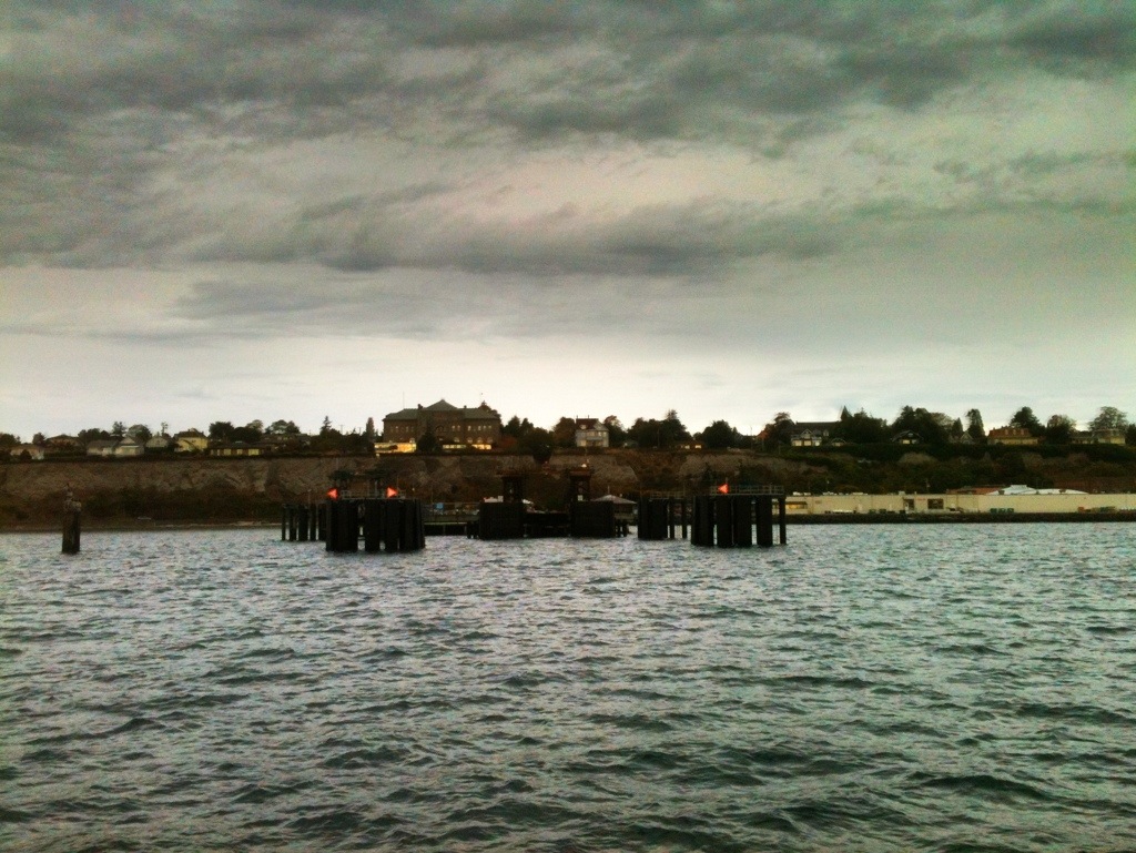
Olympic
Took the ferry from Coupeville to Port Townsend this morning. Heading into Olympic NP. Temps mild but biting with the winds out here. Am thinking about camping here if it’s not too cold and they’re still some open camp grounds.
Picture is the landing at Pt Townsend.
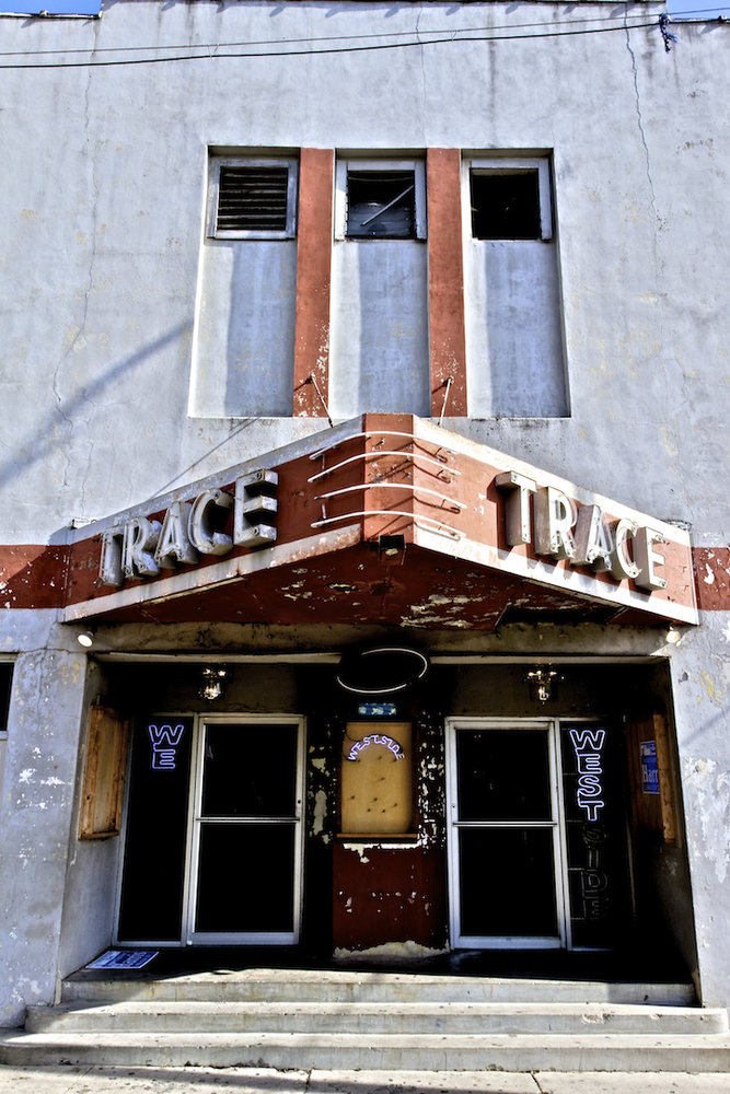
Some More of The Natchez Trace – Including a Video!
The Trace would make a nice road trip all by itself, serving as it does as an historcal connector for a dozen or more small towns between the two end points. The two I liked the most were Port Gibson, about a quarter of the way up and then Clinton, just off the Trace west of Jackson, MS.

Both these towns have done their best to take advantage of their proximity to the Trace and the tourists it brings to improve their economies. Clinton seems to have done the better of the two, but it’s also a much larger town that has Mississippi College at its core.
I had been hampered by an ingrown toe nail for most of the trip and on this morning had decided I needed to find a pharmacy that might be able to help me out. So when I saw the sign for Alcorn State University I figured it would be a good place to jump off. What college town could survive with out a drug store? Answer: One that is not a town. it’s just a college – in the middle of not a lot. So I kept on moving.
Another sign caught my eye: The Windsor Ruins. I followed and found the MS equivalent to SC’s Sheldon Church Ruins.


The other thing I learned running the Trace is that MS is a very beautiful part of the country. You should try it some time. I’m reasonably sure I will.

