Out shooting with David Toczko though still far from his standard of excellence
Out shooting with David Toczko though still far from his standard of excellence
If you click the photograph you’ll see what I mean.
Taken mostly near Cade’s Cove in Great Smoky Mountain National Park although toward the end you’ll notice a few I along the Blue Ridge Parkway in North Carolina

Big Meadows Camp in the Shenandoah National Park was a family weekend destination when I was a child. I can’t remember the last time I was here so I couldn’t resist a brief stop. It’s changed a little. More posh than I recall. But the trees remain the same – only more attractive in fog.

It started raining just after midnight and hasn’t ceased or even slowed since – has me pinned in my tent pondering the rain gear stored in the car.
Rain of this magnitude – it’s really pouring – is a normal occurrence in the Mid-Atlantic region though usually not this early in the season. Trees begin storing water in the fall to create the sap necessary to get them through winter. But early fall is six weeks off. I keep thinking as I lay stretched out here on my sleeping bag how welcome this rain would be in the Eastern Sierra – Mono Lake especially comes to mind. But if I’ve learned nothing else out here it’s that Nature is what it is; fiddling with it can be problematic. Adjusting is a better approach. As Charles says ‘It’s never a matter of wrong weather just wrong kit.’ In this case it’s right kit; wrong storage location. And a soaking trip in between.
When I arrived in Shenandoah National Park yesterday, after completing the three day run of the Blue Ridge Parkway, the sky was near crystal clear. Very unusual here where a haze is almost constantly present from the summit of Skyline Drive out across Shenandoah Valley. Not yesterday afternoon. Visibility was excellent, better than I’d ever remembered from my many trips here over the years. I immediately anticipated a grandelicious sunset. That was around 1400.
But there was rain to the south headed our way. I believe there’s something called a Tropical Depression running round the Gulf so this might be a result of its presence. This is the early edge of hurricane season in that area which tends to frequent rain in this area. (Rain is much more welcome than a hurricane.) Anyway, as the clouds rolled in about 1600 my hopes began to fade. But I thought there might be a chance so, after getting camp set up and grabbing a couple of Reese Cups and a bottle of Gatorade for dinner at the camp store, I drove the ten miles or so south to Turk Mountain Overlook and took up the vigil, camera at the ready.
Didn’t happen.
What you see, compliments of iPhone, did.

What you don’t see is my hesitance to open the tent flap and make a dash for the car to retrieve the gear I should have placed in the tent last night. I’m sure I’ll rally soon. In the meantime I’ll enjoy another chapter of Twain’s Roughing It<a
I had just about reached the end of my first day along the Blue Ridge Parkway; the sun was setting; I could simply not find a shot I liked.
Then this vineyard appeared out of nowhere.

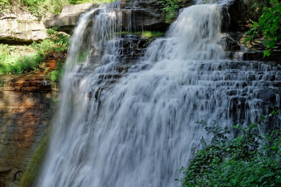
I had the opportunity to visit Cuyahoga Valley National Park last week and its Brandywine Falls of which I had snapped an iPhone photo and posted on Facebook. It received quite a bit of positive feedback so I thought you might also enjoy one of the photographs I captured with my Canon DSLR.
I suppose the real cause of my all night drive from Pictured Rocks National Seashore resulted from my dalliance along the Au Sable Point Trail. I had seen the Au Sable Light from a vantage point along the dunes about five miles north near Grand Marais and decided I needed to get a closer look. It’s reached by a trail located just off the north perimeter of the Lower Campground, about a mile and a half from the lighthouse, so when I finished up tramping around the dunes I drove down that way.
By the time I reached the trailhead it was 1930. I calculated the walk would require 30 minutes one way and given that I’m still way north (46 degrees) I’d have plenty of time to get out there do some photography and get back before dark. I was thinking about the Light not the sunset and relished the idea that for once I would be approaching my subject both at the right time of day and under near perfect weather. One of those rare times when my schedule coincided with the right everything.
The Lower Campground is hard by the lakeshore. I parked and proceeded up the path. It runs parallel to the and within feet of the shoreline providing a panoramic view of Lake Superior. As I trudged along it occurred to me that in addition to the Lighthouse I might also be able to capture shots of the sunset over the lake.
I took my time at the Light and shot it from as many angles as I could. It has stood on the point since 1874 and is one of tens such lights found around the Great Lakes area. If you’re into light houses this is the place to be – much more so than on the east or west coastlines. The shots will be the subject of the next post because I was more taken – at least for now – by what followed that part of the shoot.
I finished up, working my way around a few late evening visitors who arrived in time to clutter up the view, and headed back down the trail at a quick pace. I planned on finding a spot on the beach near where I had parked the car and taking in the ending of the day. I arrived about 2030 and looked around for a spot. It was then I also realized that I had plenty of time to run and get my tripod – always a last-minute and usually overlooked thought – as well as a lens filter that would help to cut the sun’s glare and capture more of its coloration. So I picked the items up and headed back to the beach.
I was surprised to see that just left of the place at which I entered the beach a creek was flowing into the lake at moderate to high velocity so I settled on a spot that placed its exit point between me and the sunset. The lens filter ( a variable Tiffen) allowed me to soften the sun’s rays and to slow the movement of the water. I really loved the results.
Click on the photograph to see the several different shots that are in the SmugMug Gallery

As a guy who shoots more landscape stuff than not I have a major shortcoming: I hate getting up early, as in Oh Dark Thirty early, and that tends to eliminate fifty percent of my potential subjects. Dealing with sunsets and the gloaming of the day is a breeze, but sunrises? They’re not widely represented in my growing portfolio. Not entirely absent mind you, just not plentiful.
I left Copper Harbor, MI early on Friday morning – Richard early – about 0800. Well past sunrise. My goal for the day was to make Pictured Rocks National Lakeshore on the southeastern edge of Lake Superior. The drive is roughly 300 miles and, allowing for blue highway speeds and a few pits stops and photo-ops, takes about 6 hours.
It was my intent to camp at the lakeshore. There are quite a few sites – all first come/first serve – but I anticipated no difficulty. I completely overlooked what day it was (Friday). By the time I finally made the ranger station at 2 pm all sites were spoken for. I wasn’t terribly disappointed. Camping is still more a lodging alternative than a spiritual experience for me. I assumed I’d find a motel room somewhere in the area and so set off to explore the park with little concern for time.
I do not know how many National Lakeshores there are but I do know that this one is immediately pleasing to the eye what with its dunes and forests and lights and sandy beaches. I figured out quickly why the camping areas were so popular. Pictured Rocks is a major destination draw in this part of the country and easily as impelling as anything I’d seen since leaving LA. There is a minor amount of ‘backcountry’ but the beaches and small harbors are, I believe, what attract people the most to this park. So far it’s one of the two surprise locations I’ve encountered along the way – the other being Custer State Park.
I captured some awesome sunset shots at Pictured Rocks and they’ll be up shortly but the lack of a campsite and then, after six stops and inquiries going south and finding a complete dearth of available hotel rooms, I wound up driving all night en route to Cuyahoga Valley National Park just south of Cleveland. All told a little over 800 miles from the launching point on the Upper Peninsula with only a 30 minute nap along the way at a MI rest area.
That’s the bad news.
The good news was I was up this morning before the sun was – easy if you never go to sleep. The highway south passed lake after pond after creek after river and the temps worked with all these water sources to produce an attractive morning fog. I hunt for trees in fog all the time. It’s part of my general obsession with trees. But this morning they were handed to me. And so I’m handing them to you.
Click the pic to go to the gallery on SmugMug:

Spent the day bouncing around the outskirts – and on a couple of trails at Voyageurs National Park. I knew in advance this would be challenging lacking some sort of watercraft but what I discovered is its nearly impossible to explore this place without a boat or kayak or canoe or such. And for that matter the single longest trail in the park – which is a series of islands – is designed for ski mobiles.
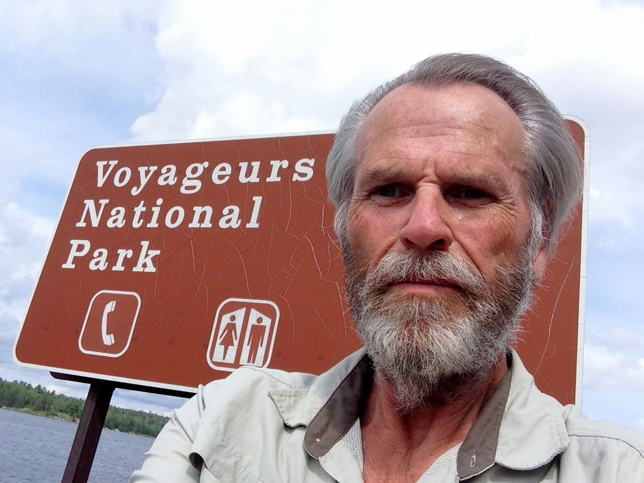 Inasmuch International Falls has a reputation for being the coldest spot in the lower forty-eight that probably makes sense. Come winter you can easily walk to Canada by shortcutting across the frozen lakes and rivers.
 No sign of border fencing up here, either US or CN
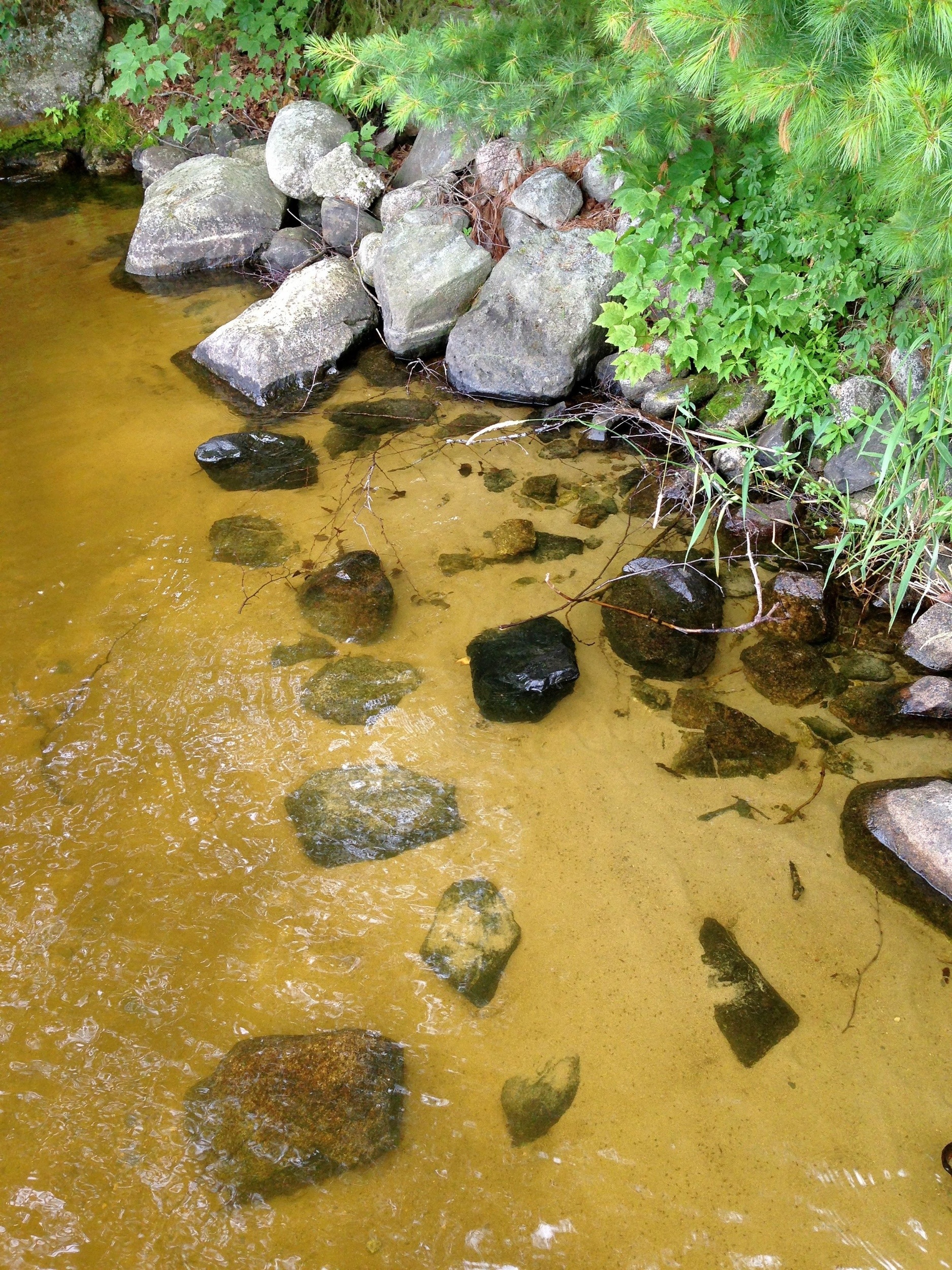
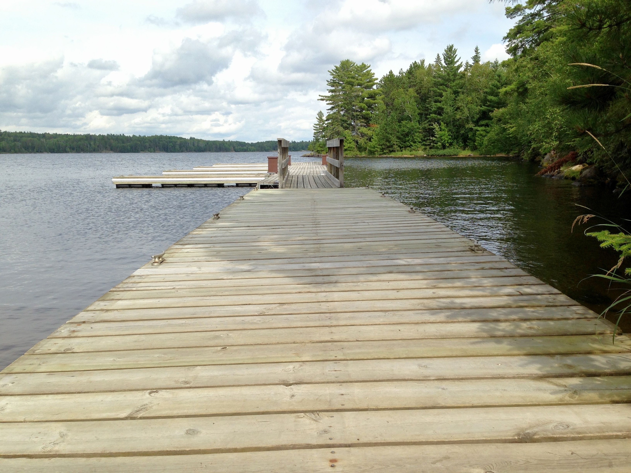 Plenty of water though.
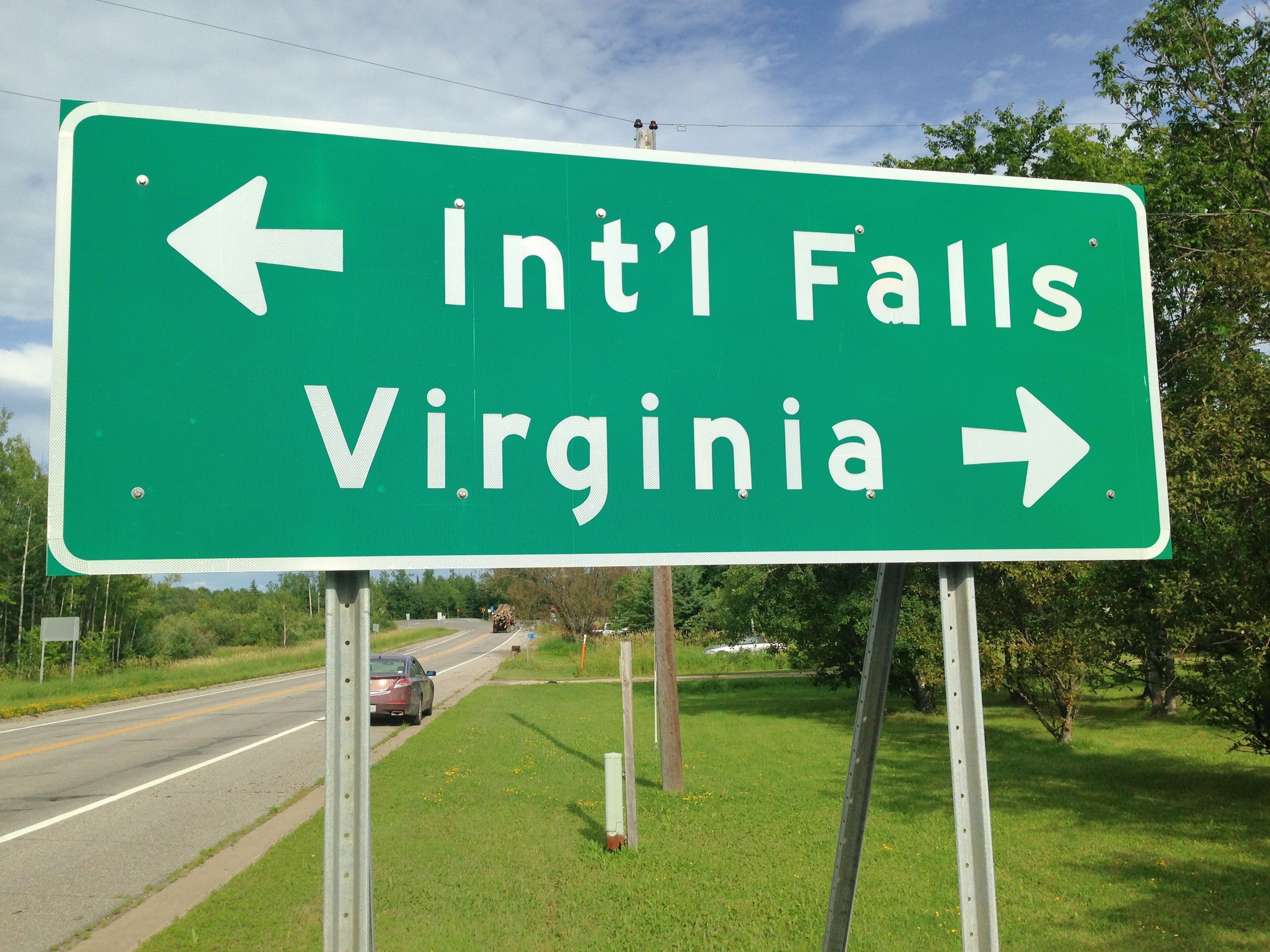
 More than enough to convince me it’s time to move on.
The next stop is Isle Royale National Park in Lake Superior. I’m a little more prepared. I’ve booked passage on a ferry for Thursday morning. This time I’m not going to be left standing on the shore wondering what it’s like on the other side.
Isle Royale is the least visited park in the Continental US. There are probably any number of reasons but certainly the $130/person ferry fee is high on the list. It’s not likely I’ll be paying these places a return visit. But they do get plenty of attention from the local population. If you like to boat or fish or really get close to a herd of moose, this is your kind of place. And if not, well, there are plenty of alternative destinations.
These past couple of days have been consumed by 8-hour-plus drives moving from the Rockies into the upper reaches of Minnesota. No single theme seems to have emerged but there are still a few thing worth mentioning and quite a few good photographs to share.
Wyoming
The first animals I saw after crossing the state line into Wyoming from Colorado were camels followed by llamas but I didn’t stop for photos. They were just past the sign welcoming visitors into the state displaying the state motto “Forever West”. This was followed closely by a billboard pointing out that hunting Wyoming’s oldest citizens (a picture of a Native American was displayed on the board), is ‘abuse’. My general thought is that lacking Yellowstone and Teton National Parks there is very little reason to be in Wyoming and and this sign, if I understood it correctly, did little to dissuade of that. Having said that the prairie land in this southeastern part of the state is beautiful, especially to my eye having spent the previous two weeks mostly in the desert. There’s a little sagebrush here; it’s mostly prairie grass and rolling hills, albeit at 5000-6000 feet. I suppose it could also be referred to as high plains. It’s worth seeing.
South Dakota
After Leaving Estes Park, CO my next scheduled stop was Wind Cave National Park in South Dakota. It’s one of three NP’s that I’m aware of that features caves (Carlsbad Caverns and Mammoth Cave being the other two). I had over looked it last I was in the area in 2011 which is why it was on the list this time through. I camped at the park – nice campground; I recommend it – and took the basic “Natural Entrance” tour. The cave contains about 140 miles of explored tunneling on multiple levels compressed into an area of one square mile. The multi-colord map of these tunnels bears resemblance to an electro-cardiogram. At its deepest the cave is 530 feet. And that level is restricted to use by research scientists. There are some unusual rock formations, principally boxwork, found in very few other places in the world.

I thought about hanging around for one more day and taking a couple of the extended tours but concluded that I just wasn’t all that interested. So I decamped and moved on. Thirteen hundred miles stood between me and my next stop at Voyageurs National Park in Minnesota.
Wind Cave NP is contiguous with Custer State Park about which I knew nothing. So I drove through on my way north and east. From what I could observe Custer is on a par with any National Park and – in my book – easily outshines Wind Cave. It’s set partially in prairie and partially in lush forest areas and is chocked full of wildlife the most prominent and prevalent of which are bison. They are everywhere.

As are elk and antelope


I wound up spending more time in Custer than I had planned and left wishing I had swapped the visitation slots between it and Wind Cave. I’m pretty sure I’ll find Custer on one of my future trip plans. it adds to the park paradoxes in SD: Crazy Horse Mountain is far more interesting than Mt Rushmore (almost anything is) and Custer State Park easily overshadows Wind Cave and on a good day is more than competitive with Badlands NP. But if you listed all these parks and asked almost anyone to to rank them for name recognition I’m virtually certain Crazy Horse Mt and Custer SP would consistently place last. Maybe if you threw Little Big Horn in to the mix….
Oh, did I mention this is Wall Drug Country?

I did stop at Badlands long enough to wade through the summer Sunday crowds to get my passport stamped, (I had not had it on my camping visit two years earlier) grab a bite to eat, and get back on the road east. Even though most of this leg of the trip is mapped along the blue highways, this section was on the I-90. You get the feeling that when the engineers who constructed this road were doing their preparations they pinned a chalk line in rapid City, ran it 350 miles east to Sioux Falls and set up a sky hook near Pierre, and snapped it. I passed through Pierre for the third time in two years with the idea of making Jamestown, ND and camping for the evening.
North Dakota
I’m now getting into the latter part of the day and beginning to get some decent light. I hadn’t snapped much during the middle of the day – it always seems like a waste of pixels to me – but now I was off the Interstate and shadows were softening. And there was virtually no traffic allowing me to stop and park and start again, sometimes in the middle of the road, without concern. I really enjoyed this part of the trip. This action series illustrates just why:


And this one:


By this point the pastoral scenes just seemed to appear in my lens


I had lost an hour on the segment crossing from Mountain to Central Time but I had also moved north to the 44th parallel where this time of year the day is longer. I managed to make Jamestown just as the sun was setting.

They seem to have me coming and going
Eighteen years ago today my life was a shambles. After a very long fall I had finally hit bottom. Far from there being no end in sight, it was staring me in the eye. I was locked on that gaze, enthralled by its deadly invitation.
Then Ruth entered my miserable existence and broke the connection. She proffered unconditional support. “You don’t have to live this way. Lets go home.” she said. The edge softened. The abyss dissolved. Her invitation overcame the previously compelling alternative. To honor this day is to honor her.
She’s gone now. Lost to a murderous disease that destroyed her body but not her spirit or her faith and certainly not her gifts or her legacy. I’ll never understand the cosmic forces that directed my salvation at her hand and then her subsequent destruction by cancer. It makes no sense to me. It’s driven me to seek an answer and is almost certainly what fuels my otherwise seemingly aimless wandering. Reconciling this paradox has become my life pursuit. I doubt the odds of success are weighted in my favor but I also realize that the process itself may in fact be the answer. It’s one of those things I’ll always know but never know.
I soldier on.
Even though the answers have so far escaped me, by Ruth’s grace I remain these last eighteen years a sober person, curious, more sane than not and far removed from the confused and tortured state she snatched me from that Saturday evening in 1995. For that and for the time I was allowed to spend with her and for all the help and support I received, and continue to receive, from the community she introduced me to, I will be forever grateful as I trudge the road of happy destiny.

Long haul road-tripping of the type I do is not all campfires and tents and bug spray and romantic things of the sort. It’s true, I get my share of skies that extend from here to there and sunsets that chase them to wherever they feel like going. It’s a good life, no question. Although some people I run into have a hard time believing I don’t get lonely or homesick. I don’t. Trust me on that.
I send cards or letters or emails and such that from time to time contain phrasing to the effect that ‘I wish you were here.’
But really?
Nah.
And it’s not you; its me. I can’t imagine there are too many people who would ever get comfortable with the way I travel. It’s just erratic. Sometimes it drives me a little batty. But as I said in some post – that never got posted – I’m never disappointed. Whatever happens is what’s supposed to happen. Do you have any idea how long it took me to figure that out? And embrace it?
Like today. I’m in Estes Park, CO which sits literally at the gate to Rocky Mountain National Park. I think this is probably one of the top five – by popularity- parks in the country. (Do you know enough about Your parks to guess the other four?) I toured it to a degree this morning. Drove up the Old Fall River Road – a one-way 9 mile stretch of unpaved switchbacks – to the Trail Ridge Rd that peaks out at 12,200 ft and parallels, in a way only engineering marvels of this type can, the Continental Divide.

Just so Chaz couldn’t accuse me of touristing the place I parked at the road peak and walked up 300 ft to the top of the hill. I found just standing up at this altitude to be difficult; I suspect most people could have duck-walked up faster than I got there – but I got there.
Phew!
The widest angle lens on my Canon struggled to capture the vistas. So if this iPhone pic looks anemic Don’t blame Steve Jobs – or me. The park is all about up and boundless. Putting that in pixels ain’t easy although I promise you’ll see a few better images shortly.
But right now I’m on one of those non-romantic runs getting new shoes on the chariot. Drove through a gawdawful rainstorm to get in here last night and experienced hydroplaning at 10,000 ft. Not a good thing. Had the original tires on the car and they had reached the limit at 78000 miles.
I wish I could refresh me as quickly and inexpensively as I did the tires. They just called my name. Job done. Back to Estes.
While I was in the process of preparing the trip plan for the journey East I received an email flyer from the University of New Mexico’s Taos Summer Writers Group. I’ve attended twice in past and once on the email list, forever on the email list. My last visit was in 2009 and even though I’ve examined the annual offerings since then it’s never quite fit my schedule.
This year proved different. I noticed that the way my plan was working out I’d be quite near Taos about the time the conference was in session. My schedule is easily modified so I scanned, the classes and workshops to see what might be of interest. I quickly determined that I’d not have time for a full week session so I concentrated on the weekend workshops. One, Travel Writing, facilitated by Stephen Benz, seemed a natural. I travel. I write (well, sort of) and I illustrate and I do most of this in this blog. This looked like a good reason to revisit Taos, the Conference, to reconnect with my friends Linda and Dan and to learn a little more about what I think I’m doing with the words I throw ’round. It had been an excellent adventure the two previous visits so why not?
I signed up.
Upon arrival I was amazed at how familiar the surroundings were. The face of Taos itself has changed since 2009 – there was no casino at the Taos Pueblo then and there are several new chain stores as well as a few new motels scattered here and there – but the Sage Brush Inn, where the conference is situated, and the conference area itself, where the meetings and such are held, doesn’t seem to have changed by so much as a single slap of adobe mud.

To meander across desert and mountain for a thousand miles or so and arrive at a place that feels like coming home – for a few days anyway – is all quite comforting to me. I’m beginning to get the same feeling recently when I see various photographic scenes from parks and cities around the country. In many cases I have my version or a slight variation of those images. It always invokes comparison of course, but it also generates a degree of belonging with the area and inspires kinship with the unknown photographer.
Driving into town on Friday afternoon in a heavy rainstorm I crossed the Rio Grande Gorge Bridge. It has been on my list of things to shoot ever since I laid eyes on it during my first visit in 2008. The concept was reinforced when I saw a shot of the Bridge that had been taken by well-known Canadian photographer, David du Chemin. I had scouted the thing in ’08 but last night decided to go back and check a bit further. Much to my chagrin I found that the Gorge near the Bridge now surrounded by high fencing topped with barbed wire. There is some construction underway but not nearly enough to call for these barriers. Nonetheless it seemed no way I was going to get what I came for. I do not care to do battle with barbed wire – and possibly the local constable.
The shot you see here was taken with my iPhone from the southeast side of the Gorge. The shot I need is from here but down the side of the Gorge about 150 feet. When I scouted in 2008 there were trails that would have taken me there. But with a fence in between….

There are lots of images around the country to capture so the Bridge is not sine qua non to a complete portfolio; but I want that shot. During lunch this afternoon I was speaking with Keith and Eva who live locally and they suggested a number of alternative approaches to climbing fences. One was to raft or kayak down to the Bridge another to drive south to a road that they know is hard by the Gorge and then hike back up to it. Keith also mentioned something about rappelling but I’m not really into extreme photography. Sounds like something my son would try (and think nothing of).
I’ll have to develop Plan B because I do not have time now to hang around and follow-up on the suggestions, most of which sound quite doable. But one thing for sure: I am not writing the shot off. I’ll be back.
I am truly grateful for the life that’s somehow come my way over the past couple of years. Eighteen years ago everything seemed to have come to a standstill. And then Ruth put it all in motion again.
Six years ago Ruth was sucked into a cancer vortex from which none of us could retrieve her and once again life lost its meaning.
It took more than a little help from quite a few old friends and not a few new ones to get me off that ledge. But they did. I did. We did.
Since then its all been unexplainable to me. It hasn’t been pain free. Life just isn’t like that. But the good has outweighed the bad by a lot and just seems to continue to gain the edge. If I believed in miracles that’s what I’d call it. But I don’t. I only rely in them.
I’m on the verge of relocating from my lifelong home in Virginia – if you’re outside the US, Google it – to newfound territory in California. People ask me if I won’t miss all those longstanding connections. I’ve given that some thought and come to the conclusion that with today’s technology the only way to lose a connection is to deliberately abandon it – which I have no intention of doing. So the answer is ‘no’. They’re not disappearing – unless of course they choose to of their own accord.
There are some whose physical presence will be sorely missed. That’s been true ever since I put myself out here on the road. But somehow we manage to reconnect and I don’t see that ending anytime soon.
And then there are the new west coast friends who’ve been added in the mix. I can’t underestimate their importance either. And all the people in between in LA, KY, TX, AR, NC, NJ, NY, NM, OH, WA, GA, and FL. ( I just know I’ve left someone’s place off that list. Argh!)
When I add them all up I’m simply overwhelmed by how blessed I am to have them in my life. I am in a word, humbled.
I doubt I’ll ever be in a position to repay the kindness I’ve been shown by the people who surround my life and hold me close within its bounds but I’m determined to try. Life for me now is defined simply as doing the next right thing. It’s not a precept with which I have a tremendous amount of experience. But I’m trying.
I look forward to getting back to the east coast in a couple of weeks. To renewing old friendships on a face to face basis and perhaps establishing a few new ones. These connections and more sustain me on this journey – to where I’m not sure. I’m just grateful I’m allowed to take it.
Hovenweep National Monument
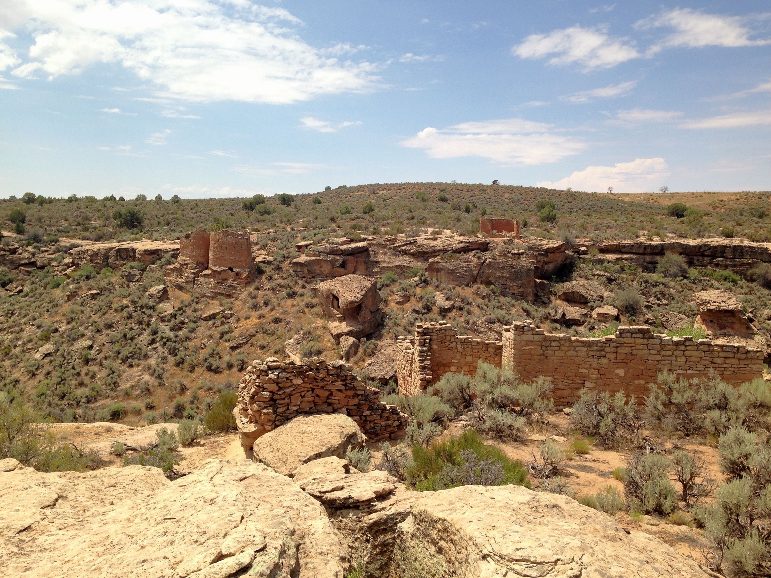
Little Ruin Canyon

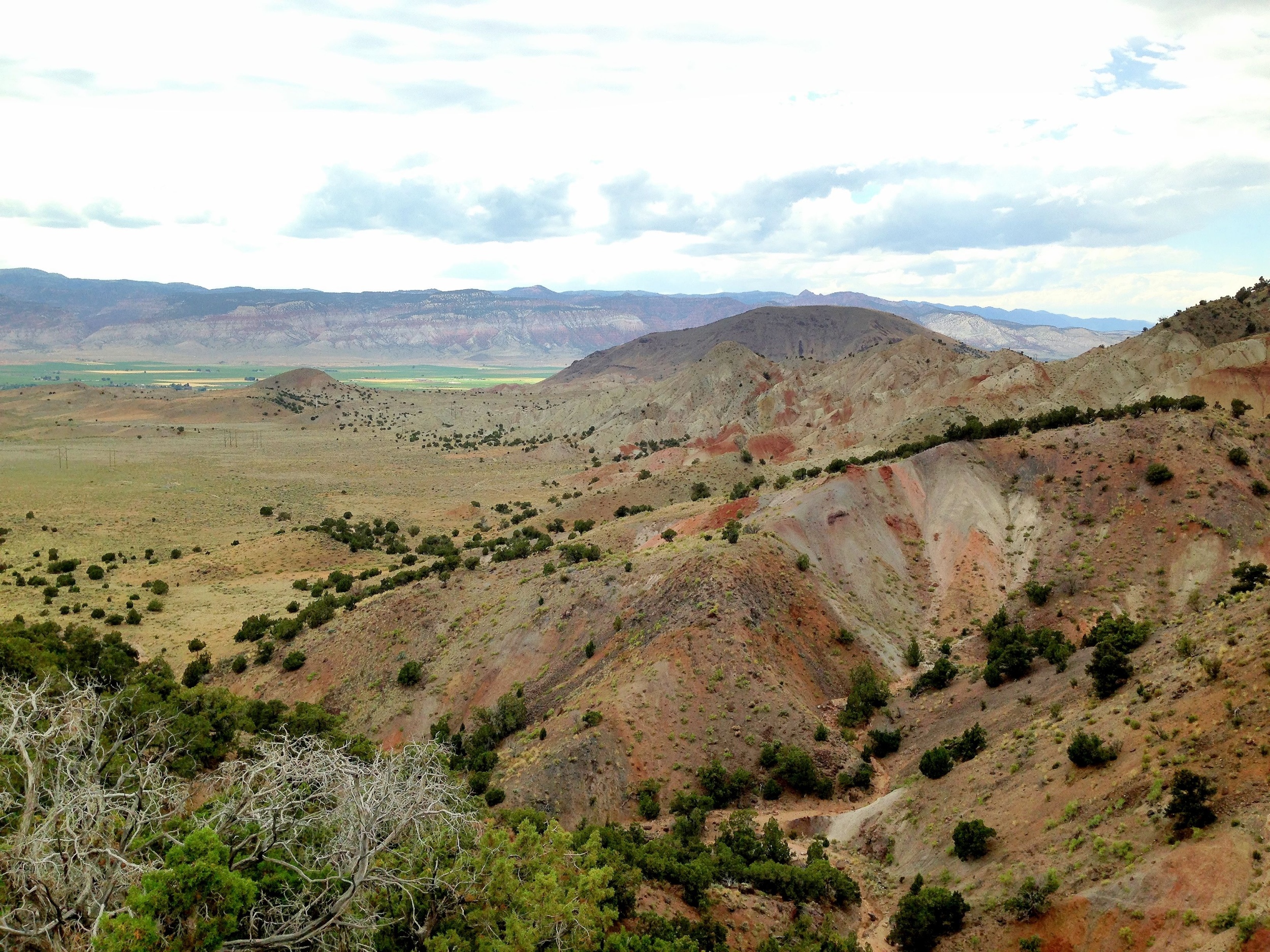
I’ve visited quite a few parks over the last several years but Capitol Reef is by far the most geologically elegant place I’ve ever laid eyes on.
This is the view from my camp for this evening. Can’t wait to explore this place further over the next couple of days.

Getting close to my next waypoint, Capitol Reef National Park, and stopped in Glenwood for gas and some cold caffeine. Climbing out this is the view you’re presented with. Don’t know that I’d care to live here but passing through is a visual pleasure.


I arrived in Los Angeles late last October with the idea of spending a few weeks before heading south to Baja for the winter and then working my way back east and home to Virginia. Well, it didn’t quite work out that way. And I’ve been in LA ever since. I’ve yet to change my voting registration and driver’s license but I’ve come to think of this beautiful place as home. For a died-in-the-wool Virginian that’s hard to believe – but it is what it is. Still, there are places back east I need to be in the near future – principally my daughter’s wedding in September – and people scattered between here and there I need to see so next week after dawdling lo these many months in the SoCal sun I begin the long trek eastward.
One of my projects, not that I’m burdened with many, is to visit and photograph each of our National Parks at least once. There are 59 all told and so far I’ve taken in 27. Nine of those by the way are in California, the state which is home to the largest number of national parks. The trip back will consume 37 days primarily because I intend visiting a few more along the way. Eleven in fact. This project gets tougher as the number increases simply because at some point it’s no longer possible to drive to my destination: there are parks in America Samoa, the Virgin Islands and Hawaii. And eight in Alaska!
I’ll figure it out.
For now I thought I’d share the itinerary in word and image:

The trip covers a little over 6,000 miles and will consume about 115 driving hours. I’m won’t get to spend as much time in each of the parks as I’d like but I know I’ll get back to many of them over the next several years.
I’m looking forward to visiting my longtime friends and maybe to making a few new ones along the way. More about the wedding later. For now I’ll just say I’m probably looking forward to it as much as any father does when it comes to his one and only (and favorite) daughter. But I’ve known my future son-in-law now for half a dozen years or more and he’s a wonderful young man. I’m sure AnnaSummer will mold him into something workable. 🙂
And next winter? Baja, of course.
I suppose at some point we’re going to see some firework displays from our vantage point on the lawn here at Burton Chace Park in the middle of the marina at Marina Del Ray.
The sun’s beginning to disappear over my right shoulder and the pan in front is a combination of yachts cruising in and out the harbor, and long lines of revelers at the half dozen or so porta johns that have been erected along the periphery of the park.
Mitzi and I have staked out a small plot of ground – seems to be shrinking – tossed our shoes and are plotting the destruction of the picnic we assembled at a Subway shop on the way down from Wooster St. There are grills going strong in every direction I look and the mixture of smells is unquestionably delicious but I’m just fine with my turkey breast and banana peppers.
If I manage to actually capture any of the sparkly part of this occasion I’ll try to share, but for now I’m going to go work on the mystery of the disappearing water fountain cross the way.
Enjoy the holiday wherever you may be. And if this is not one of your holidays just be thankful its one of ours and that ‘the generals’ haven’t shown up here since Lee and Grant got together for tea at the courthouse.


The El Mono Motel – Oldest standing Building in Lee Vining.

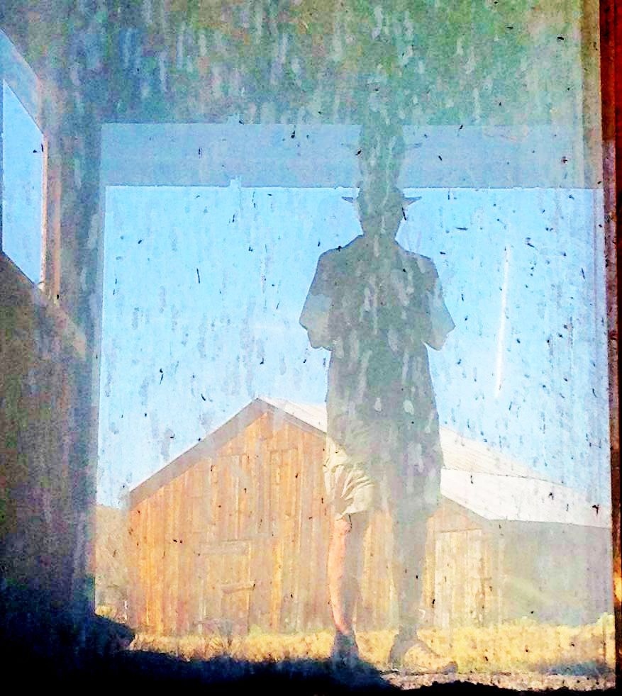
Wandering round the old Des Chambeau Ranch near Mono Lake and came across this mirror in a dilapidated garage.
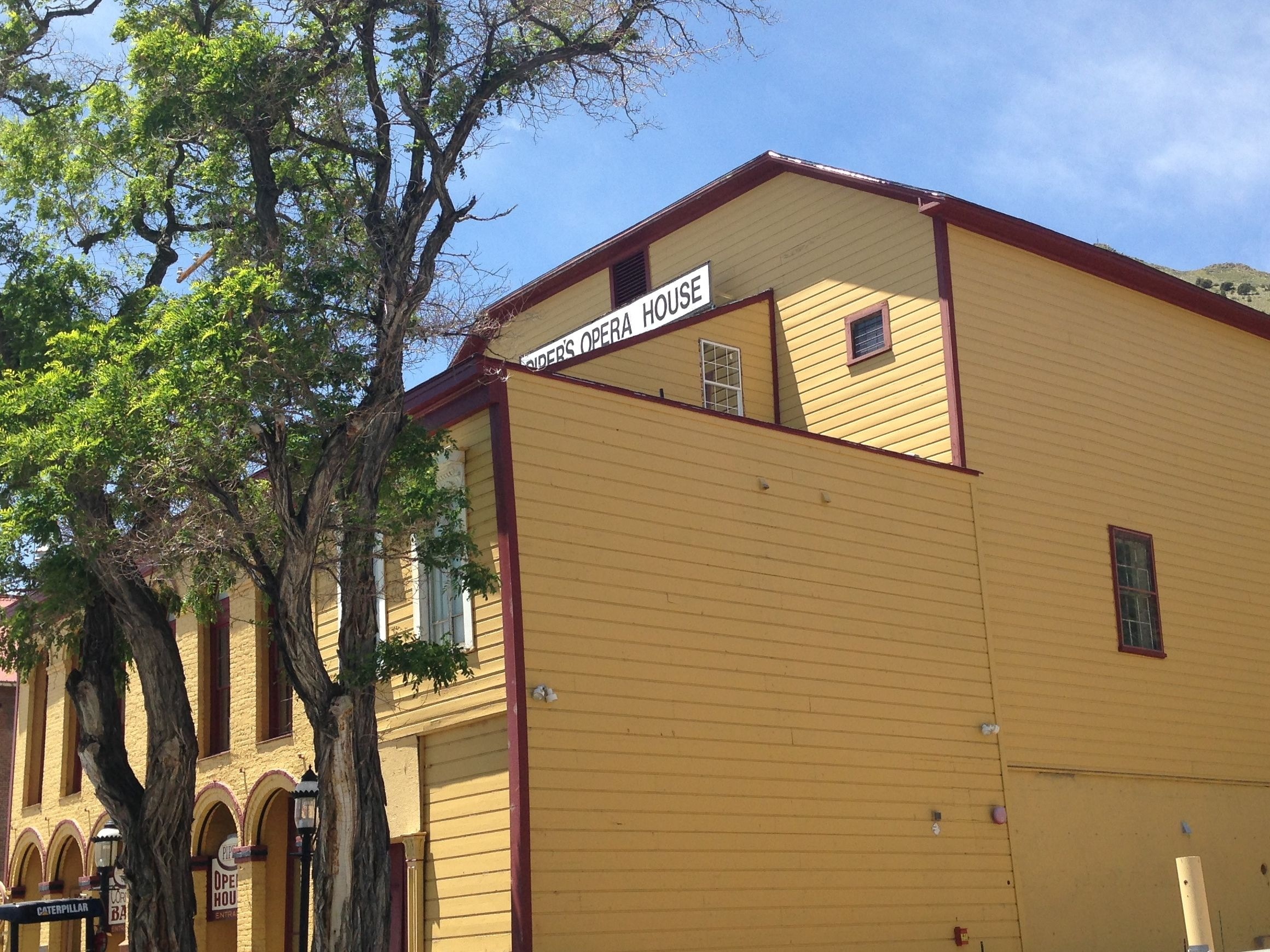
This ace reminds a lot of Harpers Ferry. It’s larger and with a western flare of course and today much a tourist attraction. The signature here is mining and gold. Except that the veins being exploited come in cars and buses. Still, below the surface there’s a motherlode of history that defines the early western expansion.
Interestingly there are still a few tangible connections. The mining continues. The gunfights have moved on to the State House.